Unincorporated community in Manitoba, Canada
| Manigotagan | |
|---|---|
| Unincorporated community | |
 | |
 | |
| Coordinates: 51°06′32″N 96°18′17″W / 51.10889°N 96.30472°W / 51.10889; -96.30472 | |
| Country | Canada |
| Province | Manitoba |
| Census division | Division No. 19 |
| Census subdivision | Unorg. Div. No. 19 |
| Area | |
| • Land | 37.06 km (14.31 sq mi) |
| Population | |
| • Total | 173 |
| Time zone | UTC-6 (CST) |
| • Summer (DST) | UTC-5 (CDT) |
| Area code(s) | 204, 431, and 584 |
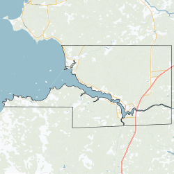
Manigotagan is a settlement in the Canadian province of Manitoba. It is located near the mouth of the Manigotagan River at Lake Winnipeg.
History
From circa 1887 to circa 1893, the Hudson's Bay Company operated a fur trade outpost here, called Bad Throat Post, and functioned as an outpost for Fort Alexander. The exact date that it was abandoned is unknown.
Demographics
In the 2021 Census of Population conducted by Statistics Canada, Manigotagan had a population of 173 living in 69 of its 273 total private dwellings, a change of -1.7% from its 2016 population of 176. With a land area of 37.06 km (14.31 sq mi), it had a population density of 4.7/km (12.1/sq mi) in 2021.
|
| ||||||||||||||||||||||||||||||
| Population count for 2016 based on revised count from 2021. Source: Statistics Canada, Government of Manitoba | |||||||||||||||||||||||||||||||
References
- ^ "Manigotagan, Northern community (NCM) Manitoba [Designated place] Census Profile, 2021 Census of Population". www12.statcan.gc.ca. Government of Canada - Statistics Canada. Retrieved May 5, 2023.
- "Geographical Names" (Esri shapefile). Manitoba Land Initiative. Retrieved April 18, 2014.
- "Manigotagan". Geographical Names Data Base. Natural Resources Canada. Retrieved May 5, 2023.
- "Hudson's Bay Company - Bad Throat Post". pam.minisisinc.com. Archives of Manitoba - Keystone Archives Descriptive Database. Retrieved May 5, 2023.
- "Population and dwelling counts: Canada and designated places". Statistics Canada. February 9, 2022. Retrieved September 3, 2022.
- "Manigotagan community profile" (PDF). www.gov.mb.ca. Government of Manitoba. March 2011. Retrieved May 8, 2023.
| Division No. 19, Manitoba (North East Manitoba) | ||
|---|---|---|
| First Nations |  | |
| Indian reserves |
| |
| Unorganized areas | ||
| Unincorporated communities | ||
This Manitoba location article is a stub. You can help Misplaced Pages by expanding it. |