 | |
| Length | 3.6 km (2.2 mi) |
|---|---|
| Location | Warsaw, Poland |
| South end | Union of Lublin Square |
| North end | Bank Square |
| Construction | |
| Inauguration | 1757 |
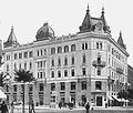
Marszałkowska Street (Polish: ulica Marszałkowska), also known by its English name Marshal Street, is one of the main thoroughfares of Warsaw, Poland, located in the district of Downtown (Śródmieście). It runs along the north–south axis, from Bank Square in the north to the Union of Lublin Square in the south.
History
Contrary to a common urban legend that attributes the name to Marshal of Poland Józef Piłsudski, the street's name actually relates to 18th-century Grand Marshal of the Crown Franciszek Bieliński.
Marszałkowska street was established by Franciszek Bieliński and opened in 1757. It was much shorter then, running only from Królewska Street to Widok Street.
The street was almost entirely destroyed during the Warsaw Uprising of 1944. Rebuilding of Warsaw after World War II coincided with emergence of socialist realism, which greatly influenced the surrounding urban architecture.
Gallery
Historical images
-
 Marszałkowska Street in 1867
-
 General view in about 1912
-
 Warsaw during World War II: destroyed townhouses between Zielna (top) and Marszałkowska streets (bottom). In bottom right corner building Marszałkowska 156 on the corner with Królewskia street, also visible Bloch Palace at Marszałkowska 154. September 1939
-
 Intersection of Marszałkowska Street and Aleje Jerozolimskie (Jerusalem Avenue) in Warsaw during German occupation. Visible tramway #3 with a billboard "Kamea woda kwiatowa". Behind it ruins of destroyed in 1939 townhouse at Marszałkowska 98/al. Jerozolimskie 33 streets.
-
 Shortly after the war, January 19, 1945. 1st Polish Army of the East Marszałkowska Street Warsaw
-
 Zamboni Brothers Tenement built in 1894.
-
 Juda Wielburski Tenement (aka Potempski Tenement) at the intersection of 2 Marszałkowska and 1 Szucha. Survived the War.
Features (before the war)
-
 Insurance Company "Rosja" in 1901
-
 Herse Tenement in 1904
-
 Rothberg Tenement in 1914
-
 Marszałkowska in 1914
See also
References
- "Warsaw History". uk.holidaysguide.yahoo.com. Archived from the original on 2007-08-21. Retrieved 2008-09-18.
- ^ "Ul. Marszałkowska" (PDF). Ilustrowany Atlas Dawnej Warszawy (in Polish). Retrieved 2008-09-18.
- ^ Dobrosław Kobielski (1984). Widoki dawnej Warszawy (Views of Old Warsaw) (in Polish). Warsaw: Krajowa Agencja Wydawnicza. ISBN 83-03-00702-5.
External links
[REDACTED] Media related to Marszałkowska Street in Warsaw at Wikimedia Commons
52°13′45″N 21°00′44″E / 52.22917°N 21.01222°E / 52.22917; 21.01222
Categories: