| This article needs to be updated. Please help update this article to reflect recent events or newly available information. (July 2019) |
| Miles Fire | |
|---|---|
| Date(s) | July 16, 2018 (2018-07-16) – October 28, 2018 (2018-10-28) |
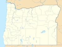
| Location | Rogue River National Forest. Oregon, United States |
| Coordinates | 42°50′53″N 122°42′40″W / 42.848°N 122.711°W / 42.848; -122.711 |
| Statistics | |
| Burned area | 54,334 acres (220 km) |
| Impacts | |
| Deaths | None reported |
| Non-fatal injuries | 0 |
| Structures destroyed | 1 |
| Damage | $95.8 million |
| Ignition | |
| Cause | Lightning |
| Map | |
 | |
The Miles Fire was a wildfire in the Rogue River National Forest in Oregon, United States. Caused by lightning, the fire burned a total of 54,334 acres over a span of 104 days.
Caused by lightning, the Miles Fire began on July 16, 2018, and later merged with the Sugar Pine and Umpqua Complex Fires.
According to the Northwest Interagency Coordination Center (NWCC), the Miles Fire was Oregon's most expensive complex to fight in 2018, costing $95.8 million.
References
- "Oregon wildfires". projects.oregonlive.com. Retrieved 2024-06-20.
- "Northwest Annual Fire Report 2018" (PDF). Northwest Interagency Coordination Center. Portland, Oregon. 2019-04-03. p. 26. Retrieved 2024-06-20.
- Urness, Zach. "Oregon wildfire costs hit record high of $514 million in 2018". Statesman Journal. Retrieved 2024-06-20.
This Oregon-related article is a stub. You can help Misplaced Pages by expanding it. |