| Mount Hum | |
|---|---|
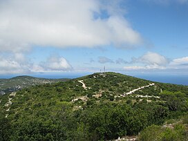
 View of Mount Hum View of Mount Hum | |
| Highest point | |
| Elevation | 587 m (1,926 ft) |
| Prominence | 587 m (1,926 ft) |
| Coordinates | 43°01′56″N 16°06′57″E / 43.032133°N 16.115808°E / 43.032133; 16.115808 |
| Geography | |
 | |
| Location | Croatia |
Mount Hum (Croatian pronunciation: [xûːm]) is a mountain located on the island of Vis, Croatia. It is the highest elevation point of Vis with its 587 metres (1,926 ft). A military radar station is located on the top and the peak is not accessible to civilians.
References
- ^ Croatian Mountaineering Association. "Vis – vrh Hum" [Vis – Mount Hum]. Retrieved 19 September 2015.
This Split-Dalmatia County geography article is a stub. You can help Misplaced Pages by expanding it. |