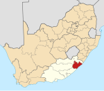
Place in Eastern Cape, South Africa
| Mqanduli | |
|---|---|
  | |
| Coordinates: 31°49′S 28°45′E / 31.817°S 28.750°E / -31.817; 28.750 | |
| Country | South Africa |
| Province | Eastern Cape |
| District | O.R. Tambo |
| Municipality | King Sabata Dalindyebo |
| Area | |
| • Total | 9.88 km (3.81 sq mi) |
| Population | |
| • Total | 2,647 |
| • Density | 270/km (690/sq mi) |
| Racial makeup (2011) | |
| • Black African | 99.1% |
| • Coloured | 0.3% |
| • Indian/Asian | 0.3% |
| • White | 0.2% |
| • Other | 0.1% |
| First languages (2011) | |
| • Xhosa | 94.7% |
| • English | 2.5% |
| • Other | 2.8% |
| Time zone | UTC+2 (SAST) |
| Postal code (street) | 5080 |
| PO box | 5080 |
| Area code | 047 |
Mqanduli is a town in OR Tambo District Municipality in the Eastern Cape province of South Africa.
Village 30 km south of Mthatha and 22 km north-east of Elliotdale. Named after a nearby hill; of Xhosa origin, the name is said to mean 'grindstone-maker', after a person living there.
References
- ^ "Main Place Mqanduli". Census 2011.
- "Dictionary of Southern African Place Names (Public Domain)". Human Science Research Council. p. 319.
| Municipalities and communities of OR Tambo District Municipality, Eastern Cape | ||
|---|---|---|
| District seat: Mthatha | ||
| Ingquza Hill |  | |
| Port St Johns | ||
| Nyandeni | ||
| Mhlontlo | ||
| King Sabata Dalindyebo | ||
This Eastern Cape location article is a stub. You can help Misplaced Pages by expanding it. |