| Natural Bridge Park | |
|---|---|
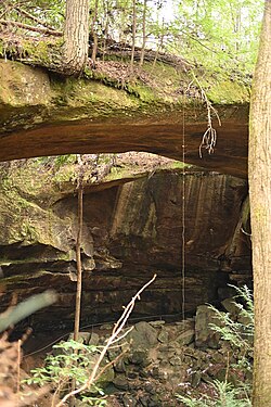 Natural arches at the Park. Natural arches at the Park. | |
| Location | Winston County, Alabama |
| Nearest town | Natural Bridge, Alabama |
| Coordinates | 34°05′35″N 87°36′53″W / 34.09306°N 87.61472°W / 34.09306; -87.61472 |
| Opened | 1954 (1954) |
| Owned by | Donnie and Naomi Lowman |
| Operated by | Donnie and Naomi Lowman |
| Status | open |
| Hiking trails | 2 mile nature path |
Natural Bridge Park, near the town of Natural Bridge, Alabama, is a privately owned park in Winston County that has been open since 1954. The current owners are Donnie and Naomi Lowman.
The Park's primary attraction is a natural-arch rock formation that is 60 feet (18 m) high, 148 feet (45 m) long, and composed of sandstone and iron ore. The bridge is purported to be the longest natural arch east of the Rocky Mountains in North America. A two-mile nature trail guides visitors beneath the arch and past nearby rock formations. Walking across the bridge itself is not permitted, due to safety concerns.
The Park includes picnic accommodations, an artesian well that supplies drinking fountains, a gift shop featuring hand-crafted items, 27 varieties of fern, and a stand of eastern hemlock (Tsuga canadensis)—a species that dates back to the Pleistocene epoch (approximately 2,580,000 to 11,700 years ago).
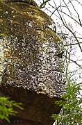
Downhill from the arch is an outcropping of rock resembling a Native American head in right profile, similar to that of an old U.S. "Indian head" nickel. The stone formation is just over 15 feet (4.6 m) high.
As of 2024, the park is open from 8:00 am until 4:00 pm seven days a week and admission is $10.00 for adults.
History
This natural-arch formation dates back about 200 million years. It was formed by the New River eroding weaker sandstone away from the stronger stone bridge spans. creating an erosion feature: natural-bridge.
Muscogee Creek Indians lived in this area, and they probably used the bridge-cave enclosure for shelter.
The Park itself was opened to the public by the Legg family in 1954. In recent years, it was owned and operated by Jim and Barbara Denton. In August 2023, Donnie and Naomi Lowman purchased it and are now running it (as of January 2024).
Gallery
-
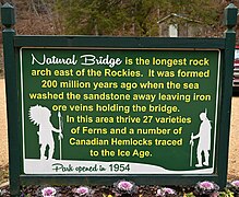 Entrance sign.
-
 Entrance and gift shop.
-
 View from under the arch, looking upward.
-
 Under the bridge.
-
 Looking outward, wintertime.
-
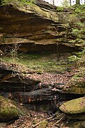 Rock formation visible from the nature trail.
-
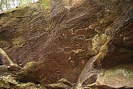 Eroded rock
-
 Eroded rock
-
 19th-century graffiti
Notes
- ^ Alisa Beckwith, "Natural Bridge History", "Small-Town Pride in Natural Bridge", from The Tuscaloosa News, Tuscaloosa, AL, February 10, 2002, webpage: geocities-NatBridge.
- ^ Ettractions.com, "Natural Bridge of Alabama", 2008.
- ^ "Natural Bridge Park". Encyclopedia of Alabama. Retrieved 2024-01-15.
- ^ "Natural Bridge Park Saved". Northwest Alabamian. 2023-08-23. Retrieved 2024-01-06.
- "Natural Bridge, Alabama (Cities)", 2008, Online Highways, webpage: OHwy-naturalb.
- "Natural Bridge Park". Alabama Mountain Lakes Tourist Association. Retrieved 2024-01-15.
- "Britannica Online Service :: Search", Britannica Online, 2009, webpage: EB-n6.
External links
- "Natural Bridge in Alabama". Archived from the original on June 13, 2018.
- Gann, Pamela (2022-09-23). "Everything you need to know when visiting Natural Bridge Park, Alabama". Pam Gann. Retrieved 2024-01-15.
34°05′35″N 87°36′53″W / 34.09306°N 87.61472°W / 34.09306; -87.61472
Categories:
