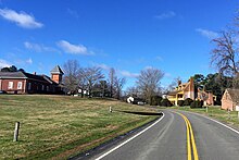

New Kent is a census-designated place (CDP) in and the county seat of New Kent County, Virginia, United States. The population as of the 2020 Census was 739.
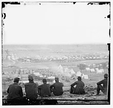
Cumberland Landing, Cumberland Plantation, and the Cumberland Marsh Natural Area Preserve are near New Kent.
Criss Cross and St. Peter's Church are listed on the National Register of Historic Places, and New Kent High School and George W. Watkins High School are National Historic Landmarks.
Notable people
- Jamion Christian, former head coach, men’s basketball, George Washington University (DC).
- Jarrell Christian, head coach, Maine Celtics.
- Letitia Christian Tyler, the first wife of President John Tyler and first lady of the United States from 1841 to 1842.
- Martha Washington, George Washington’s wife 1st First Lady of the United States of America.
Demographics
| Census | Pop. | Note | %± |
|---|---|---|---|
| 2010 | 239 | — | |
| 2020 | 739 | 209.2% | |
| U.S. Decennial Census 2010–2020 | |||
2020 census
| Race / Ethnicity | Pop 2010 | Pop 2020 | % 2010 | % 2020 |
|---|---|---|---|---|
| White alone (NH) | 197 | 574 | 82.43% | 77.67% |
| Black or African American alone (NH) | 23 | 77 | 9.62% | 10.42% |
| Native American or Alaska Native alone (NH) | 0 | 1 | 0.00% | 0.14% |
| Asian alone (NH) | 1 | 5 | 0.42% | 0.68% |
| Pacific Islander alone (NH) | 0 | 1 | 0.00% | 0.14% |
| Some Other Race alone (NH) | 0 | 5 | 0.00% | 0.68% |
| Mixed Race/Multi-Racial (NH) | 12 | 38 | 5.02% | 5.14% |
| Hispanic or Latino (any race) | 6 | 38 | 2.51% | 5.14% |
| Total | 239 | 739 | 100.00% | 100.00% |
Note: the US Census treats Hispanic/Latino as an ethnic category. This table excludes Latinos from the racial categories and assigns them to a separate category. Hispanics/Latinos can be of any race.
See also
References
- "Find a County". National Association of Counties. Retrieved June 7, 2011.
- "New Kent CDP, Virginia". United States Census Bureau. Retrieved January 30, 2022.
- "National Register Information System". National Register of Historic Places. National Park Service. July 9, 2010.
- "Census of Population and Housing from 1790". US Census Bureau. Retrieved January 24, 2022.
- ^ "P2 HISPANIC OR LATINO, AND NOT HISPANIC OR LATINO BY RACE - 2020: DEC Redistricting Data (PL 94-171) - New Kent CDP, Virginia". United States Census Bureau.
- "P2 HISPANIC OR LATINO, AND NOT HISPANIC OR LATINO BY RACE - 2010: DEC Redistricting Data (PL 94-171) - New Kent CDP, Virginia". United States Census Bureau.
| Municipalities and communities of New Kent County, Virginia, United States | ||
|---|---|---|
| County seat: New Kent | ||
| CDP |  | |
| Unincorporated communities | ||
37°31′04″N 76°58′44″W / 37.51778°N 76.97889°W / 37.51778; -76.97889
This New Kent County, Virginia state location article is a stub. You can help Misplaced Pages by expanding it. |