| Ondrašovce | |
|---|---|
| Village | |
 | |
 | |
| Coordinates: 48°59′N 21°05′E / 48.983°N 21.083°E / 48.983; 21.083 | |
| Country | Slovakia |
| Region | Prešov |
| District | Prešov |
| First mentioned | 1427 |
| Government | |
| • Mayor | Jozef Lopuchovský (Smer-SD) |
| Area | |
| • Total | 4.36 km (1.68 sq mi) |
| Elevation | 460 m (1,510 ft) |
| Population | |
| • Total | 60 |
| • Density | 14/km (36/sq mi) |
| Postal code | 082 33 |
| Car plate | PO |
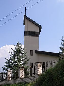
Ondrašovce (Hungarian: Andrásvágás) is a village and municipality in the Prešov District of the Prešov Region of eastern Slovakia.
History
In the historical records the village was first mentioned in 1427.
Geography
The municipality lies at an altitude of 460 metres and covers an area of 4.356 km². It has a population of about 60 people.
References
- "Súbory na stiahnutie - Voľby do orgánov samosprávy obcí 2022". volby.statistics.sk. Retrieved 11 August 2024.
- "Registry of Land" (PDF). www.skgeodesy.sk. Retrieved 11 August 2024.
- "SODB2021 - Population - Basic results". www.scitanie.sk. Retrieved 11 August 2024.
- Nové obzory (in Slovak). Vydalo Východoslovenské vydavatelstvo pre Múzeum Slovenskej republiky rád v Prešove. 1971. p. 156. Retrieved 11 August 2024.
This Prešov Region geography article is a stub. You can help Misplaced Pages by expanding it. |