| This article needs additional citations for verification. Please help improve this article by adding citations to reliable sources. Unsourced material may be challenged and removed. Find sources: "Oued el Melah" – news · newspapers · books · scholar · JSTOR (March 2022) (Learn how and when to remove this message) |

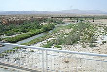
Oued el Melah or Wadi el Melah (Arabic: وادي مالح, وادي المالح, "Salty Wadi") is an intermittent wadi of Tunisia whose course is located on the territory of the governorates of Gafsa and Tozeur. Generally dry, except when it rains, the wadi has its mouth in Chott el-Gharsa.

It is almost a river for a series of wadis in the area between Gafsa and Tozeur, forming a waterway for a distance of 70 kilometers. The decrease in precipitation in the area means that it does not carry water any more, except in the case of rain, usually occurring during the fall and winter.
The towns of Lalla, El Ksar and Guettaria are on the river.
References
- Oued el Melah.
- Oued el Melah: Tunisia National Geospatial-Intelligence Agency.
This Tunisia location article is a stub. You can help Misplaced Pages by expanding it. |