| Papagayo River | |
|---|---|
 | |
| Location | |
| Country | Mexico |
| State | Guerrero |
| Physical characteristics | |
| Mouth | |
| • coordinates | 16°41′05″N 99°36′38″W / 16.684718°N 99.61065°W / 16.684718; -99.61065 |
| • elevation | Sea level |
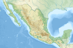
The Papagayo River is a river in Guerrero state of southern Mexico. Its headwaters are in the Sierra Madre del Sur, and it drains southwards to empty into the Pacific Ocean southeast of the city of Acapulco.
The natural vegetation varies with elevation. Pine–oak forest is the predominant at higher elevations in the upper watershed. tropical dry forest grows at middle and low elevations. Much of the original vegetation has been altered by human activity, and there are extensive areas of secondary vegetation, including woodland, shrubland, and savanna, as well as cropland, forest plantation, and livestock pasture.
See also
References
- "Rio Papagayo". GeoNames. Retrieved July 26, 2021.
- Wiken, Ed, Francisco Jiménez Nava, and Glenn Griffith. 2011. North American Terrestrial Ecoregions—Level III. Commission for Environmental Cooperation, Montreal, Canada.
- Galicia, L., Zarco-Arista, A.E., Mendoza-Robles, K.I., Palacio-Prieto, J.L. and García-Romero, A. (2008), Land use/cover, landforms and fragmentation patterns in a tropical dry forest in the southern Pacific region of Mexico. Singapore Journal of Tropical Geography, 29: 137-154. https://doi.org/10.1111/j.1467-9493.2008.00326.x
- Atlas of Mexico. 1975. Archived from the original on 2007-06-14.
- American World Atlas. Prentice Hall. 1984.
- The New International Atlas. Rand McNally. 1993.
This article related to a river in Mexico is a stub. You can help Misplaced Pages by expanding it. |