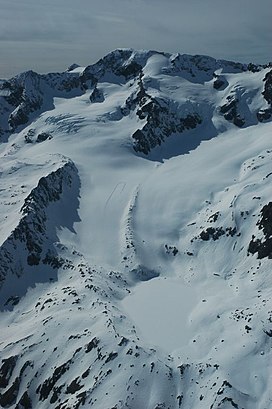
| Pic Bayle | |
|---|---|
 Pic Bayle Pic Bayle | |
| Highest point | |
| Elevation | 3,465 m (11,368 ft) |
| Prominence | 1,175 m (3,855 ft) |
| Listing | Alpine mountains above 3000 m |
| Coordinates | 45°08′17″N 6°08′09″E / 45.13806°N 6.13583°E / 45.13806; 6.13583 |
| Geography | |
 | |
| Parent range | Dauphiné Alps |
| Climbing | |
| First ascent | 1874 by Joseph Bayle |
Pic Bayle is a summit in the Dauphiné Alps, culminating at a height of 3,465 m (11,368 ft), the highest point of the Massif des Grandes Rousses. It is above the resort of Alpe d'Huez.
References
- "Pic Bayle". Peakbagger.com. Retrieved 16 January 2015.
- Source : Géoportail avec carte IGN à l'échelle 1:25000
This Isère geographical article is a stub. You can help Misplaced Pages by expanding it. |