| Pyakupur Пякупур | |
|---|---|
 | |
 | |
| Location | |
| Country | Russia |
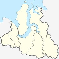
| Region | Yamalia |
| Physical characteristics | |
| Source | Siberian Uvaly |
| • location | near Muravlenko, Yamalia |
| • coordinates | 63°12′11″N 73°54′18″E / 63.203°N 73.905°E / 63.203; 73.905 |
| • elevation | 111 m (364 ft) |
| Mouth | Pur |
| • location | near Tarko-Sale, Yamalia |
| • coordinates | 64°56′50″N 77°48′50″E / 64.9472°N 77.8139°E / 64.9472; 77.8139 |
| • elevation | 16 m (52 ft) |
| Length | 542 km (337 mi) |
| Basin size | 31,400 km (12,100 sq mi) |
| Discharge | |
| • average | 290 m/s (10,000 cu ft/s) |
| Basin features | |
| Progression | Pur→ Kara Sea |
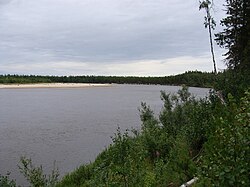
The Pyakupur (Russian: Пякупур) is a river in Yamalo-Nenets Autonomous Okrug, Russia, the left source river of the Pur. The length of the Pyakupur is 542 km. The area of its basin is 31,400 km. There are approximately 32,600 lakes in the river basin. The main tributaries: Vyngypur (right) and Purpe (left). The river's peak month of discharge is June. The average discharge of water 290 m/s.
See also
References
- "Pyaku-Pur At Tarko-Sale". University of New Hampshire. Retrieved 3 March 2015.
- "Река АЙВАСЕДА(П-ПУР) in the State Water Register of Russia". textual.ru (in Russian)., erroneously called "Ayvaseda"
This Yamalo-Nenets Autonomous Okrug location article is a stub. You can help Misplaced Pages by expanding it. |
This article related to a river in Siberia is a stub. You can help Misplaced Pages by expanding it. |