| This article relies largely or entirely on a single source. Relevant discussion may be found on the talk page. Please help improve this article by introducing citations to additional sources. Find sources: "Reigolil River" – news · newspapers · books · scholar · JSTOR (June 2024) |
| Reigolil River | |
|---|---|
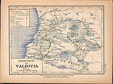
 Trancura River, east of Villarica Lake in a 1903 map Trancura River, east of Villarica Lake in a 1903 map | |
| Location | |
| Country | Chile |
| Physical characteristics | |
| Mouth | |
| • location | Trancura River |
Reigolil River (Spanish: Río Reigolil, Spanish pronunciation: [rejˈɣolil]) is the main tributary to Trancura River in La Araucanía Region, Chile. Reigolil River flows from north to south following the Reigolil-Pirihueico Fault. The river has a catchment area that includes the southern slopes of Sollipulli Volcano in the north and a large portion of land east of Huerquehue National Park.
See also
References
- "Araucanía region, Chile". Britannica. nd.
| Hydrography of La Araucanía Region | ||
|---|---|---|
| Rivers |  | |
| Waterfalls | ||
| Lakes | ||
This La Araucanía Region location article is a stub. You can help Misplaced Pages by expanding it. |
This article related to a river in Chile is a stub. You can help Misplaced Pages by expanding it. |