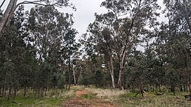
| Ringwood Tank State Forest | |
|---|---|
 | |
| Geography | |
| Location | South Western Slopes, New South Wales, Australia |
| Coordinates | 35°55′21″S 146°16′48″E / 35.92250°S 146.28000°E / -35.92250; 146.28000 |
| Area | 231 ha (2.3 km; 0.9 sq mi) |
| Administration | |
| Governing body | Forestry Corporation of NSW |
| Ecology | |
| Dominant tree species | White cypress pine |
| Lesser flora | Grey box |
Ringwood Tank State Forest is a native forest, located in the South Western Slopes region of New South Wales, in eastern Australia. The 231 ha (570-acre) state forest is located approximately 12 km (7.5 mi) north-west of Corowa.
Etymology
The place name Ringwood Tank is derived from the dam located in the northern section of the reserve.
Environment
Ringwood Tank State Forest is dominated by white cypress pine. Other plant species present within the forest include grey box and bulloak.
At least six species listed under the Biodiversity Conservation Act 2016 have been recorded within the state forest, including squirrel glider, brolga, brown treecreeper, grey-crowned babbler, hooded robin, and varied sittella.
See also
References
- "NSW State Forests" (PDF). Forestry Corporation. 17 March 2014. Archived (PDF) from the original on 5 March 2023. Retrieved 2 July 2024.
- ^ "Regional Forest Assessment: South-western cypress state forests" (PDF). Natural Resources Commission. Archived (PDF) from the original on 14 March 2023. Retrieved 2 July 2024.
- "Forests NSW forest management zones - Riverina Region" (PDF). Forestry Corporation of NSW. January 2008. Archived (PDF) from the original on 7 March 2023. Retrieved 2 July 2024.
- "Ringwood Tank". Geographical Names Board of New South Wales. Archived from the original on 3 July 2024. Retrieved 2 July 2024.