
Road signs in New Zealand are similar to those set by the Vienna Convention on Road Signs and Signals. While New Zealand is not a signatory to the convention, its road signs are generally close in shape and function. New Zealand uses yellow diamond-shaped signs for warnings in common with Australia, the Americas, Ireland, Japan and Thailand. Speed limit signs are a red circle with a white background and the limitation in black, and are in kilometres per hour. There are also some signs unique to New Zealand. Road signs in New Zealand are controlled by NZ Transport Agency Waka Kotahi and are prescribed in the Land Transport Rule: Traffic Control Devices 2004 and set out in the Traffic Control Devices (TCD) Manual.
Most of these signs were only introduced between 1987 and 1990, replacing older-style signs with white text on black backgrounds: square with a red border for regulatory signs and diamond with a yellow border. Warning signs and the Give Way sign were replaced from 1987, regulatory signs from 1989, and parking signs from 1990. The only signs that remained the same were the Stop sign and the speed limit sign (although the "km/h" legend from metrication was removed). Some of the older signs can still be seen on some rural roads. New Zealand drives on the left.
Speed limits are posted in multiples of 10 kilometres per hour (6.2 mph), and range from 10–110 km/h (6–68 mph), with 110 km/h being the maximum legal speed for motor vehicles in New Zealand. The Manual of Traffic Signs and Markings specifies that advisory speeds (PW-25) always end in digit "5", however there are some advisory speed signs that do not comply with the manual and end in zero.
In 2023, the then Labour government made moves to have bilingual road signs with English and Māori. One poll found 48% of the New Zealand public supported the idea, with 44% opposing. Another poll found 32% were in support and opposition was at 45%.
Regulatory signs
-
 10 km/h speed limit
-
 20 km/h speed limit
-
 30 km/h speed limit
-
 40 km/h speed limit
-
 50 km/h speed limit
-
 60 km/h speed limit
-
 70 km/h speed limit
-
 80 km/h speed limit
-
 90 km/h speed limit
-
 100 km/h speed limit
-
 110 km/h speed limit
-
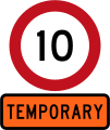 Temporary 10 km/h speed limit
-
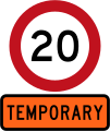 Temporary 20 km/h speed limit
-
 Temporary 30 km/h speed limit
-
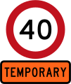 Temporary 40 km/h speed limit
-
 Temporary 50 km/h speed limit
-
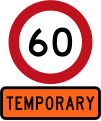 Temporary 60 km/h speed limit
-
 Temporary 70 km/h speed limit
-
 Temporary 80 km/h speed limit
-
 Speed limit derestricted (no posted speed limit, maximum of 100 km/h applies but drive to conditions)
-
 Speed limit at times prescribed on school days
-
 School speed limit
-
 Beach speed limits
-
 Riverbed speed limits
-
 Locality speed limit
-
 Locality speed limit
-
 Stop
Stop
-
 Give Way
-
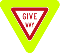 Give Way (fluorescent version)
-
 Straight ahead traffic give way
-
 Right turning traffic give way
-
 Left turning traffic give way
-
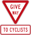 Give way to cyclists
-
 Give way to cyclists and pedestrians
-
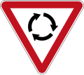 Give Way at Roundabout (give way to vehicles coming from the right)
-
 Give Way at Roundabout (fluorescent version)
-
 School Patrol Stop (used by crossing wardens when children are crossing the street, vehicles must stop)
-
 Perforated version
-
 Stop on Red Signal (used at traffic lights)
-
 Stop Here on Red Signal (used at traffic lights)
-
 Give Way to Oncoming Vehicles
-
 Priority Over Oncoming Vehicles
-
 Turning Traffic Give Way To Pedestrians
-
 Turning Traffic Give Way To Cyclists
-
 Straight Ahead Traffic Give Way To Cyclists
-
 One Vehicle per Green each lane (used underneath ramp meters on motorway on-ramps)
-
 No Left Turn
-
 No Right Turn
-
 No U-turn
-
 No Entry
-
 No entry except buses
-
 No entry except cycles
-
 No entry except authorised vehicles
-
 Road Closed
-
 Wrong Way
-
 Wrong Way - Go Back
-
 Turn Left
-
 Proceed Straight Ahead (no turns allowed)
-
 Turn Right
-
 Turn Left or Right
-
 One-way traffic (pointing left)
-
 One-way traffic (pointing right)
-
 Keep Left
-
 Keep Left (narrow version)
-
 Keep Right
-
 Keep Right (narrow version)
-
 School Street
-
 This Lane Must Turn Left
-
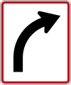 This Lane Must Turn Right
-
 This Lane Must Proceed Straight
-
 This Lane May Proceed Straight or Turn Left
-
 This Lane May Proceed Straight or Turn Right
-
 Traffic may use the Below Lane - National Speed Limit applies (Used on motorways where variable speed limits usually apply, but are inactive at the time.)
-
 Traffic may use the Below Lane (Variable sign used when Dynamic Lanes are in use, and in some motorway tunnels.)
-
 Lane Closure Ahead - Traffic merge left (Used on motorways where variable lane control is used.)
-
 Lane Closure Ahead - Traffic merge right (Used on motorways where variable lane control is used.)
-
 Only traffic using the next exit may use the below lane (Used on motorways where variable lane control is used.)
-
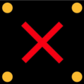 Lane Closed - Traffic May Not use the Below Lane (Used on where variable lane control or Dynamic Lanes are used.)
-
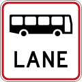 Bus Lane
-
 Buses Only
-
 Transit Lane ends
-
 Transit Lane ends
-
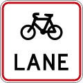 Cycle Lane
-
 Cycles Only
-
 Heavy Vehicle/Truck Lane
-
 Shared Cycle and Pedestrian Path
-
 Cyclists and Pedestrians Maintain Sides
-
 Cyclists and Pedestrians Maintain Sides
-
 Emergency Stopping Lane Only
-
 Emergency Stopping Lane Only during times specified
-
 Emergency Stopping Lane
-
 Signal bypass transit lane for vehicles carrying 2 or more persons and heavy vehicles exceeding 3500 kilograms
-
 Signal bypass transit lane for vehicles carrying 3 or more persons and heavy vehicles exceeding 3500 kilograms
-
 Signal bypass transit lane for vehicles carrying 2 or more persons and heavy vehicles exceeding 3500 kilograms
-
 Signal bypass transit lane for vehicles carrying 3 or more persons and heavy vehicles exceeding 3500 kilograms
-
 Do not Stop for Signals
-
 Signals do not apply
-
 Signals do not apply
-
 Bus and Electric Vehicle Lane
-
 Buses and Electric Vehicles Only
-
 Transit lane for vehicles carrying 2 or more persons and electric vehicles irrespective of the number of persons in the vehicle
-
 Transit lane for vehicles carrying 3 or more persons and electric vehicles irrespective of the number of persons in the vehicle
-
 Transit lane for vehicles carrying 2 or more persons, heavy vehicles exceeding 3500 kilograms and electric vehicles irrespective of the number of persons in the vehicle
-
 Transit lane for vehicles carrying 3 or more persons, heavy vehicles exceeding 3500 kilograms and electric vehicles irrespective of the number of persons in the vehicle
-
 No Cycles or Mopeds
-
 No Pedestrians
-
 No Heavy Vehicles/Trucks
-
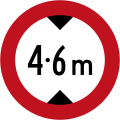 Maximum Height Restriction
-
 Pedestrians Only (marks a pedestrian zone where motor vehicles are prohibited)
-
 Cycles Must Exit
-
 Class C road (Heavy vehicles can drive on this road only to deliver or collect goods or passengers along the road)
-
 Class I road
-
 Class I road until date specified
-
 Maximum Length for Heavy Vehicles
-
 Heavy vehicle axle weight limit
-
 No cruising zone
-
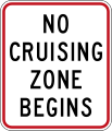 No cruising zone begins
-
 No cruising zone ends
-
 Keep Left Unless Passing
-
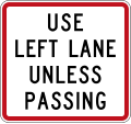 Use Left Lane Unless Passing
-
 Regulatory sign effective ahead
-
 Regulatory sign effective begins
-
 Regulatory sign effective ends
-
 Regulatory sign effective in 100 metres
-
 Regulatory sign effective in 200 metres
-
 Regulatory sign effective in 300 metres
Parking signs
-
 No Stopping
-
 Directional arrow supplementary plate (on the left side of this sign)
-
 Directional arrow supplementary plate (on the right side of this sign)
-
 Directional arrow supplementary plate (on both sides of this sign)
-
 No Stopping (on the left side of this sign)
-
 No Stopping (on the right side of this sign)
-
 No Stopping (on both sides of this sign)
-
 No Stopping at times prescribed (on the left side of this sign)
-
 No Stopping at times prescribed (on the right side of this sign)
-
 No Stopping at times prescribed (on both sides of this sign)
-
 Late Night Extension
-
 Clearway (No Stopping) (with single peak time)
-
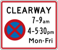 Clearway (No Stopping) (with two peak times)
-
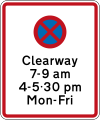 Clearway (No Stopping) during times specified
-
 Clearway Begins
-
 Clearway Ends
-
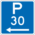 Parking Permitted: 30 Minutes (on the left of this sign, standard hours)
-
 Parking Permitted: 30 Minutes (on the right of this sign, standard hours)
-
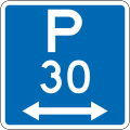 Parking Permitted: 30 Minutes (on both sides of this sign, standard hours)
-
 Late Night Extension
-
 Parking Permitted: 30 Minutes (on the left of this sign, non-standard hours)
-
 Parking Permitted: 30 Minutes (on the right of this sign, non-standard hours)
-
 Parking Permitted: 30 Minutes (on both sides of this sign, non-standard hours)
-
 Parking Permitted: 30 Minutes (on the left of this sign, other times)
-
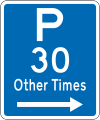 Parking Permitted: 30 Minutes (on the right of this sign, other times)
-
 Parking Permitted: 30 Minutes (on both sides of this sign, other times)
-
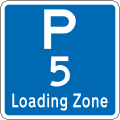 Loading Zone Parking: 5 Minutes
-
 Good Vehicles Only
-
 5 Minute Maximum, Goods Vehicles Only
-
 Motorcycle Parking
-
 Cycle Parking
-
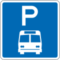 Bus Parking: No Limit
-
 Tour Coaches Only
-
 Shuttle Parking: No Limit
-
 Disabled Parking: No Limit
-
 No Parking
-
 No Parking: Bus Stop
-
 No Parking: Bus Stop
-
 No Parking: Coach Stop
-
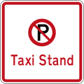 No Parking: Taxi Stand
-
 No Parking: Shuttle Stop
-
 No Parking: Tram Stop
-
 No Parking: Emergency Vehicle Stop
-
 Coupon Parking Zone Begins
-
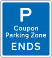 Coupon Parking Zone Ends
-
 Coupon Parking Zone (repeater sign)
-
 Pay & Display Parking
-
 Vehicles With Permits Exempt
-
 Parking For Authorised Vehicles Only
General advisory
-
 No Exit
-
 Left Turn At Any Time With Care (usually used on slip lanes)
-
 Warning Bells At Railway Crossing Turned Off (at times prescribed)
-
 Shared Zone
-
 Construction Zone (to the left)
-
 Construction Zone (to the right)
-
 Railway Not In Use
-
 Motorway Begins (80 km/h speed limit)
-
 Motorway Begins (100 km/h speed limit)
-
 Motorway Begins
-
 Motorway Begins
-
 Motorway Ends 100M
-
 Motorway Ends
-
 Motorway Ends
-
 Motorway Ends (30 km/h speed limit)
-
 Motorway Ends (40 km/h speed limit)
-
 Motorway Ends (50 km/h speed limit)
-
 Motorway Ends (60 km/h speed limit)
-
 Motorway Ends (70 km/h speed limit)
-
 Motorway Ends (80 km/h speed limit)
-
 Motorway Ends (90 km/h speed limit)
-
 Expressway Begins
-
 Expressway Begins
-
 Expressway Ends 100m
-
 Expressway Ends
-
 Expressway Ends
-
 Heavy Vehicle By Pass Ahead (in 200 metres)
-
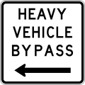 Heavy Vehicle By Pass (on left)
-
 Heavy Vehicle By Pass (on right)
-
 Passing Lane Ahead (in 1 kilometre)
-
 Passing Bay Ahead (in 100 metres)
-
 Slow Vehicle Bays (for the next 2 kilometres)
-
 Slow Vehicle Bay Ahead (in 300 metres)
-
 Slow Vehicle Bay (indicator sign)
-
 Heavy Vehicles Please Do Not Use Engine Brakes (for the next 4 kilometres)
-
 Stock Effluent Disposal Point Ahead (on left, in 300 metres)
-
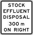 Stock Effluent Disposal Point Ahead (on right, in 300 metres)
-
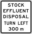 Stock Effluent Disposal Point Ahead (turning left, in 300 metres)
-
 Stock Effluent Disposal Point Ahead (turning right, in 300 metres)
-
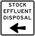 Stock Effluent Disposal Point (turn left)
-
 Stock Effluent Disposal Point (turn right)
-
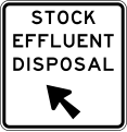 Stock Effluent Disposal Point (veer left)
-
 Stock Effluent Disposal Point (veer right)
-
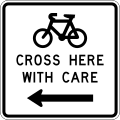 Cyclists Cross Here With Care (to the left)
-
 Cyclists Cross Here With Care (to the right)
-
 Cyclists Use Left Shoulder
-
 Cyclists Use Ramp
-
 Safety camera area (Speed cameras / red light cameras nearby)
-
 Average speed camera area
Warning signs
-
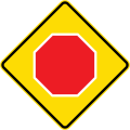 Stop ahead
-
 Give Way ahead
-
 10 km/h speed limit ahead
-
 20 km/h speed limit ahead
-
 30 km/h speed limit ahead
-
 40 km/h speed limit ahead
-
 50 km/h speed limit ahead
-
 60 km/h speed limit ahead
-
 70 km/h speed limit ahead
-
 80 km/h speed limit ahead
-
 90 km/h speed limit ahead
-
 Traffic signals ahead
-
 Prepare to stop ahead
-
 Hidden queue ahead
-
 Queued vehicles ahead
-
 Roundabout ahead
-
 Priority road straight ahead
-
 Priority road turns left
-
 Priority road turns right
-
 Controlled T-junction (priority turns left)
-
 Controlled T-junction (priority turns right)
-
 Uncontrolled T-junction
-
 Controlled side road junction on left
-
 Controlled side road junction on right
-
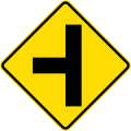 Uncontrolled side road junction on left
-
 Uncontrolled side road junction on right
-
 Controlled Y-junction on right
-
 Controlled Y-junction on left
-
 Uncontrolled Y-junction
-
 Merging traffic from left
-
 Merging traffic from right
-
 Merging traffic from both sides
-
 Lane gain on left
-
 Lane gain on right
-
 90 degree curve, to left
-
 90 degree curve, to right
-
 Curve between 15 and 90 degrees, to left
-
 Curve between 15 and 90 degrees, to right
-
 Sharp curve between 90 and 120 degrees, to left
-
 Sharp curve between 90 and 120 degrees, to right
-
 Dangerous curve greater than 120 degrees, to left
-
 Dangerous curve greater than 120 degrees, to right
-
 Reverse curve less than 60 degrees, to left
-
 Reverse curve less than 60 degrees, to right
-
 Reverse curve greater than 60 degrees, to left
-
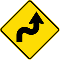 Reverse curve greater than 60 degrees, to right
-
 Reverse curve with decreasing radius, to left
-
 Reverse curve with decreasing radius, to right
-
 Series of curves ahead, first to left
-
 Series of curves ahead, first to right
-
 Sign effective for the next 2 kilometres
-
 Advisory speed: 15 km/h
-
 Advisory speed: 25 km/h
-
 Advisory speed: 35 km/h
-
 Advisory speed: 45 km/h
-
 Advisory speed: 55 km/h
-
 Advisory speed: 65 km/h
-
 Advisory speed: 75 km/h
-
 Advisory speed: 85 km/h
-
 Advisory speed: 95 km/h
-
 Curve between 15 and 90 degrees with minor road, to left
-
 Curve between 15 and 90 degrees with minor road, to right
-
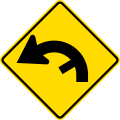 Curve between 90 and 120 degrees with minor road, to left
-
 Curve between 90 and 120 degrees with minor road, to right
-
 Concealed
-
 Truck advisory speed (danger of rollover if speed is exceeded)
-
 Truck advisory speed (danger of rollover if speed is exceeded)
-
 Road narrows on left
-
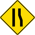 Road narrows on right
-
 Road narrows on both sides
-
 Narrow bridge
-
 Tunnel ahead
-
 Narrow Bridge, wide vehicles may come into your lane
-
 Maximum overhead clearance ahead
-
 Maximum height marker
-
 Overhead electrical cables
-
 Road diverges (splits)
-
 Two-way traffic ahead
-
 Road dip
-
 Speed bump
-
 Uneven road or series of bumps ahead
-
 Falling rocks or debris on left
-
 Falling rocks or debris on right
-
 Slippery road
-
 Road slippery when frosty
-
 Road slippery when wet
-
 Road has slippery gravel surface
-
 Loose road surface (danger of stir up)
-
 Attention: Other Dangers! (never used alone, a supplementary plate will explain the danger)
-
 Ford
Ford
-
 Cattle stop
-
 Gate
Gate
-
 Steep descent
-
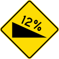 Steep descent (with grade)
-
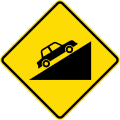 Steep ascent
-
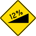 Steep ascent (with grade)
-
 Use lower gear
-
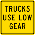 Trucks use lower gear
-
 Railway level crossing on side road to left
-
 Railway level crossing on side road to right
-
 Railway level crossing on side road to left
-
 Railway level crossing on side road to right
-
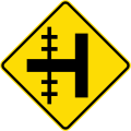 Railway level crossing on side road to left
-
 Railway level crossing on side road to right
-
 Railway level crossing on controlled T-junction to left
-
 Railway level crossing on controlled T-junction to right
-
 Railway level crossing on uncontrolled T-junction to left
-
 Railway level crossing on uncontrolled T-junction to right
-
 Railway Crossbuck
-
 Railway Crossbuck (with red backing board)
-
 Uncontrolled railway crossing ahead
-
 Uncontrolled railway crossing ahead
-
 Controlled railway crossing ahead with signals and gates
-
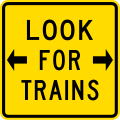 Look both ways for trains before crossing
-
 Cyclists take care on rail tracks
-
 Railway crossing ahead at a right angle
-
 Railway crossing ahead at an oblique angle
-
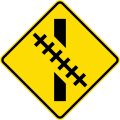 Railway crossing ahead at an oblique angle
-
 Light rail crossing
-
 Light rail crossing
-
 Pedestrians
-
 Aged pedestrians
-
 Pedestrian crossing ahead
-
 School crossing ahead
-
 Kōhanga reo crossing ahead
-
 Pedestrian crossing (Belisha beacon)
-
 Children
-
 School
-
 Kindergarten
-
 Kōhanga reo
-
 School bus route
-
 School bus turning area
-
 Watch for cyclists
-
 Cyclists merging
-
 Cyclists crossing
-
 Watch for horseriders
-
 Narrow bridge when cyclists present
-
 Marae ahead
-
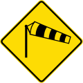 Danger of powerful wind gusts
-
 Low-flying aircraft
-
 Low-flying helicopters
-
 Watch for animals (cattle)
-
 Watch for animals (sheep)
-
 Watch for animals (deer)
-
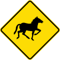 Watch for animals (wild horses)
-
 Watch for animals (seals)
-
 Watch for animals (pūkeko)
-
 Watch for animals (ducks)
-
 Watch for animals (penguins)
-
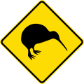 Watch for animals (kiwi)
-
 Watch for animals (kererū)
-
 Watch for trucks
-
 Fire station
-
 Watch for forklifts and other work vehicles
-
 Roundabout hazard marker
-
 End of road marker (used at T-junctions)
-
 End of road marker (used at T-junctions)
-
 Curve marker
-
 Curve marker
-
 Island curve marker
-
 Island curve marker
-
 Curve marker with integrated advisory speed
-
 Curve marker with integrated advisory speed
-
 Curve marker with integrated advisory speed
-
 Curve marker with integrated advisory speed
Temporary warning signs
-
 Road Works Ahead
-
 Grader
-
 Mower
Mower
-
 Weed sprayer
-
 Road marking
-
 On side road
-
 Shoulder closed
-
 Surveying
-
 Wet tar
-
 Skid testing
-
 Bridge repairs
-
 Road workers ahead in 1 kilometre
-
 Road workers ahead in 1 kilometre, delays possible
-
 Works End
-
 Road works speed limit ahead - 10 km/h
-
 Road works speed limit ahead - 20 km/h
-
 Road works speed limit ahead - 30 km/h
-
 Road works speed limit ahead - 40 km/h
-
 Road works speed limit ahead - 50 km/h
-
 Road works speed limit ahead - 60 km/h
-
 Road works speed limit ahead - 70 km/h
-
 Road works speed limit ahead - 80 km/h
-
 Works end, thank you
-
 Attention - Other Dangers! (never used alone, a supplementary plate will explain the danger)
-
 Flooding
-
 Washout
-
 Line crew
-
 Blasting
-
 Tree Felling
-
 Trucks Crossing
-
 Logging Trucks
-
 No Road Markings
-
 Signals Changed
-
 Signals Not Working
-
 New Road Layout
-
 Traffic Survey
-
 Cycle Race
-
 Runners
-
 Walkers
-
 Cyclists ahead
-
 Runners ahead
-
 Walkers ahead
-
 Accident
-
 Fire
Fire
-
 Funeral
-
 Film Crew
-
 Hidden Queue
-
 Barriers Not Working
-
 Pedestrians
-
 Trains Running
-
 Falling rocks or debris on left
-
 Falling rocks or debris on right
-
 Slippery road
-
 Slippery road surface due to ice or grit
-
 Slow when wet
-
 Loose road surface
-
 New seal
-
 Seal repairs
-
 Watch for large animals (cattle)
-
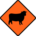 Watch for large animals (sheep)
-
 Traffic signals ahead
-
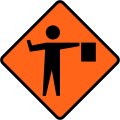 Flagman ahead
-
 Please stop on request (for flagman)
-
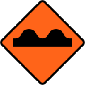 Rough road surface
-
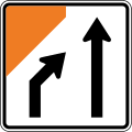 Lane management (two lanes, left lane merges)
-
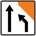 Lane management (two lanes, right lane merges)
-
 Lane management (three lanes, left lane merges)
-
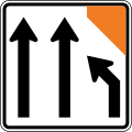 Lane management (three lanes, right lane merges)
-
 Lane management (three lanes, middle lane merges to the left)
-
 Lane management (three lanes, middle lane merges to the right)
-
 Lane management (four lanes, left lane merges)
-
 Lane management (four lanes, right lane merges)
-
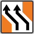 Lane management (two lanes shift to the left)
-
 Lane management (two lanes shift to the right)
-
 Lane management (three lanes shift to the right)
-
 Lane management (three lanes shift to the right)
-
 Lane management (lane entering from the left)
-
 Lane management (lane joining traffic from the right)
-
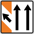 Lane management (lane exiting to the left)
-
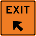 Exit marker
-
 Road narrows on left
-
 Road narrows on right
-
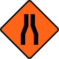 Road narrows on both sides
-
 Road narrows to a single lane
-
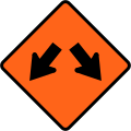 Road diverges (splits)
-
 Road closed ahead
-
 Exit closed ahead
-
 Detour ahead - follow circle symbol
-
 Detour ahead - follow diamond symbol
-
 Detour ahead - follow square symbol
-
 Detour ahead - follow state highway shield
-
 State highway detour ahead - follow state highway shield
-
 Detour - follow circle symbol (straight ahead, left-hand)
-
 Detour - follow circle symbol (straight ahead, right-hand)
-
 Detour - follow circle symbol (to the left)
-
 Detour - follow circle symbol (to the right)
-
 Detour - follow circle symbol (veer left)
-
 Detour - follow circle symbol (veer right)
-
 Detour - follow diamond symbol (straight ahead, left-hand)
-
 Detour - follow diamond symbol (straight ahead, right-hand)
-
 Detour - follow diamond symbol (to the left)
-
 Detour - follow diamond symbol (to the right)
-
 Detour - follow diamond symbol (veer left)
-
 Detour - follow diamond symbol (veer right)
-
 Detour - follow square symbol (straight ahead, left-hand)
-
 Detour - follow square symbol (straight ahead, right-hand)
-
 Detour - follow square symbol (to the left)
-
 Detour - follow square symbol (to the right)
-
 Detour - follow square symbol (veer left)
-
 Detour - follow square symbol (veer right)
-
 Detour - follow state highway shield (straight ahead, left-hand)
-
 Detour - follow state highway shield (straight ahead, right-hand)
-
 Detour - follow state highway shield (to the left)
-
 Detour - follow state highway shield (to the right)
-
 Detour - follow state highway shield (veer left)
-
 Detour - follow state highway shield (veer right)
-
 Detour Ends
-
 Crossing closed - please use alternative crossing
-
 Footpath closed - please use other side
-
 Pedestrians follow this sign (straight ahead, left-hand)
-
 Pedestrians follow this sign (straight ahead, right-hand)
-
 Pedestrians follow this sign (to the left)
-
 Pedestrians follow this sign (to the right)
-
 Pedestrians follow this sign (veer left)
-
 Pedestrians follow this sign (veer right)
-
 Cyclists follow this sign (straight ahead, left-hand)
-
 Cyclists follow this sign (straight ahead, right-hand)
-
 Cyclists follow this sign (to the left)
-
 Cyclists follow this sign (to the right)
-
 Cyclists follow this sign (veer left)
-
 Cyclists follow this sign (veer right)
-
 Emergency
-
 Breakdown warning triangle
-
 Pilot Car. Follow Me
-
 Road Works
-
 Road Inspection
-
 Pass With Care
-
 Cement Splashes - Wash Car Today
-
 Lime Splashes - Wash Car Today
-
 Dry Your Brakes
-
 Thank You
-
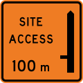 Works site access - 100 metres ahead on left
-
 Works site access - 100 metres ahead on right
-
 Works site access - 200 metres ahead on left
-
 Works site access - 200 metres ahead on right
-
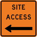 Works site access on left
-
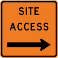 Works site access on right
Vehicle Mounted
-
 School Bus signals (orange lights will flash when children are boarding and disembarking)
-
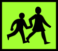 School Vehicle
-
 School Bus (affixed to school buses)
-
 School (affixed to school buses)
-
 Danger - Slow Down
-
 Pilot Vehicle (for an over-dimension convoy)
-
 House Ahead (house-carrying truck convoy ahead)
-
 House Follows (house-carrying truck follows behind pilot)
-
 Long Load Ahead (extra-long vehicle convoy ahead)
-
 Long Load Follows (extra-long vehicle convoy follows behind pilot)
-
 Wide Load Ahead (extra-wide vehicle convoy ahead)
-
 Wide Load Follows (extra-wide vehicle convoy follows behind pilot)
Route marker shields
-
 State Highway 1 marker
-
 State Highway 1B marker
-
 State Highway 1C marker
-
 State Highway 1N marker
-
 State Highway 2 marker
-
 State Highway 3 marker
-
 State Highway 3A marker
-
 State Highway 4 marker
-
 State Highway 5 marker
-
 State Highway 6 marker
-
 State Highway 6A marker
-
 State Highway 7 marker
-
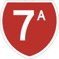 State Highway 7A marker
-
 State Highway 8 marker
-
 State Highway 8A marker
-
 State Highway 8B marker
-
 State Highway 10 marker
-
 State Highway 11 marker
-
 State Highway 12 marker
-
 State Highway 14 marker
-
 State Highway 15 marker
-
 State Highway 16 marker
-
 State Highway 18 marker
-
 State Highway 20 marker
-
 State Highway 20A marker
-
 State Highway 20B marker
-
 State Highway 20 marker
-
 State Highway 20 marker
-
 State Highway 20 marker
-
 State Highway 20 marker
-
 State Highway 20 marker
-
 State Highway 25A marker
-
 State Highway 26 marker
-
 State Highway 27 marker
-
 State Highway 28 marker
-
 State Highway 29 marker
-
 State Highway 29A marker
-
 State Highway 30 marker
-
 State Highway 30A marker
-
 State Highway 31 marker
-
 State Highway 32 marker
-
 State Highway 33 marker
-
 State Highway 34 marker
-
 State Highway 35 marker
-
 State Highway 36 marker
-
 State Highway 37 marker
-
 State Highway 38 marker
-
 State Highway 39 marker
-
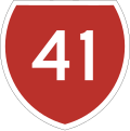 State Highway 41 marker
-
 State Highway 43 marker
-
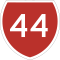 State Highway 44 marker
-
 State Highway 45 marker
-
 State Highway 46 marker
-
 State Highway 47 marker
-
 State Highway 48 marker
-
 State Highway 49 marker
-
 State Highway 50 marker
-
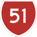 State Highway 51 marker
-
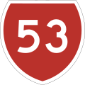 State Highway 53 marker
-
 State Highway 54 marker
-
 State Highway 56 marker
-
 State Highway 57 marker
-
 State Highway 58 marker
-
 State Highway 59 marker
-
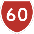 State Highway 60 marker
-
 State Highway 62 marker
-
 State Highway 63 marker
-
 State Highway 65 marker
-
 State Highway 67 marker
-
 State Highway 67A marker
-
 State Highway 69 marker
-
 State Highway 71 marker
-
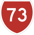 State Highway 73 marker
-
 State Highway 74 marker
-
 State Highway 74A marker
-
 State Highway 75 marker
-
 State Highway 76 marker
-
 State Highway 77 marker
-
 State Highway 78 marker
-
 State Highway 79 marker
-
 State Highway 80 marker
-
 State Highway 82 marker
-
 State Highway 83 marker
-
 State Highway 84 marker
-
 State Highway 85 marker
-
 State Highway 86 marker
-
 State Highway 87 marker
-
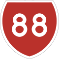 State Highway 88 marker
-
 State Highway 90 marker
-
 State Highway 93 marker
-
 State Highway 94 marker
-
 State Highway 95 marker
-
 State Highway 96 marker
-
 State Highway 97 marker
-
 State Highway 98 marker
-
 State Highway 99 marker
Obsolete signs
-
 10 km/h speed limit (Used until 2016)
-
 20 km/h speed limit (Used until 2016)
-
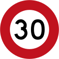 30 km/h speed limit (Used until 2016)
-
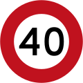 40 km/h speed limit (Used until 2016)
-
 50 km/h speed limit (Used until 2016)
-
 60 km/h speed limit (Used until 2016)
-
 70 km/h speed limit (Used until 2016)
-
 80 km/h speed limit (Used until 2016)
-
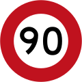 90 km/h speed limit (Used until 2016)
-
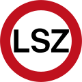 Limited speed zone (maximum speed limit of 100 km/h, reduces to 50 km/h during dangerous conditions such as bad weather) (Used until 2009)
Pre-1987 signs
-
 Give way
-
 Traffic signals ahead
-
 Roundabout
-
 Crossroads with priority ahead
-
 Crossroads with priority (route turns left)
-
 Crossroads with priority (route turns right)
-
 Two-way traffic ahead
-
 Slips
Slips
-
 Pedestrians
-
 Pedestrian crossing ahead
-
 Children
-
 Fire station
Pre-1989 signs
-
 Turning traffic give way to pedestrians
-
 One way
-
 One way
-
 Keep left
-
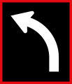 This Lane May Turn Left
-
 This Lane May Turn Right
-
 This Lane May Proceed Straight
-
 This Lane May Proceed Straight or Turn Left
-
 This Lane May Proceed Straight or Turn Right
-
 Class C road
-
 Class I road
-
 No Exit
-
 Warning bells at railway crossing turned off
-
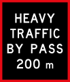 Heavy Vehicle By Pass Ahead
-
 Heavy Vehicle By Pass Ahead
-
 Heavy Vehicle By Pass
-
 Heavy Vehicle By Pass
-
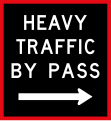 Heavy Vehicle By Pass
Obsolete route marker shields
-
 State Highway 1A marker
-
 State Highway 2A marker
-
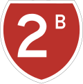 State Highway 2B marker
-
 State Highway 15A marker
-
 State Highway 17 marker
-
 State Highway 40 marker
-
 State Highway 49A marker
-
 State Highway 50A marker
-
 State Highway 52 marker
-
 State Highway 57A marker
-
 State Highway 61 marker
-
 State Highway 70 marker
-
 State Highway 73A marker
-
 State Highway 91 marker
-
 State Highway 92 marker
Location Referencing Management System (LRMS)
The NZ Transport Agency (NZTA; Māori: Waka Kotahi) uses a linear location referencing system for its State Highway network, nationwide. This assists roading contractors, safety auditors and emergency services in pin-pointing locations across the country. The LRMS features several types of signs and methods of reference. All KMP's are installed using a calibrated Trip Meter from the beginning of the road. ERP's however, are placed using land surveying equipment.
All LRMS signs are installed on the 'true left' side of the lane or carriageway, this is determined by the left hand side when facing the increasing direction, The increasing direction of travel is the direction in which positive measurements are made. Divided carriageways (roads with concrete berms or centrelines) have an Increasing (I) side and a Decreasing (D) side. This can be seen on LRMS signs in these areas.
Established Route Position (ERP)
Established Route Position signs are used to highlight a special location or bearing on the highway, These are placed routinely along the carriageways, usually every 3 km. They feature the current Reference Station and the number of kilometres from the beginning of that Reference Station. These are required by the NZTA to have an accuracy of less than 3 metres. ERP signs are double-sided and feature a reflective green strip. They also have a small yellow triangle on the post pointing in the roads increasing direction.
Kilometre Marker Post (KMP)
Kilometre Marker Post signs are used to highlight the progression along the highway, These are placed routinely along the carriageways, every 1000 metres. They feature the State Highway Shield, the current Reference Station and the number of kilometres from the beginning of that Reference Station. These are required by the NZTA to have an accuracy of less than 100 metres. KMP signs are on plastic, flexible posts. They are double-sided and feature a reflective black strip.
Reference Station (RS)
Reference Station signs are placed at the change of a Reference Station, or beginning of a Highway. KMP and ERP signs are reset to zero at the beginning of each RS.
-
 ERP Sign (SH1, Route Station 594, 3 km)
-
 KMP Sign (SH1, Route Station 594, 1 km)
-
 RS Sign (SH1, Route Station 591)
See also
References
- Traffic Control Devices Manual. New Zealand Transport Agency. Retrieved 15 July 2012.
- "More road signs to change". The Press. 23 February 1989. p. 21.
- Charlton, S.G.; de Pont, J.J. (2007). Curve Speed Management (PDF). Land Transport New Zealand Research Report 323. Wellington: Land Transport New Zealand. p. 22. ISBN 978-0-478-28735-6. Retrieved 26 September 2013.
- Lau, Chris (30 July 2023). "Lost in translation: How New Zealand's plan for bilingual road signs took an unexpected turn". CNN. Retrieved 26 February 2024.
- McClure, Tess (6 June 2023). "New Zealand political battle erupts over bilingual road signs". The Guardian. ISSN 0261-3077. Retrieved 26 February 2024.
- "A nation divided: New poll shows Kiwis split on rolling out bilingual road signs". Newshub. Archived from the original on 24 November 2023. Retrieved 26 February 2024.
- "The Post".
- "LANE AND CARRIAGEWAY SIGNALS (LCS) - ITS Delivery Specification" (PDF). p. 17.
- https://www.nzta.govt.nz/assets/resources/location-ref-management-sys-manual/docs/SM051-part-b.pdf New Zealand Transport Agency LRMS Manual SM051 Retrieved 18-03-2019
| Traffic signs | |||||||||||||||
|---|---|---|---|---|---|---|---|---|---|---|---|---|---|---|---|
| Signs |
| ||||||||||||||
| By country |
| ||||||||||||||
| Lights | |||||||||||||||
| Typefaces | |||||||||||||||
| International conventions |
| ||||||||||||||
| National standards | |||||||||||||||
| Comparisons | |||||||||||||||
| Road signs in Oceania | |
|---|---|
| Sovereign states | |
| Associated states of New Zealand | |
| Dependencies and other territories | |