| Saint-Servais Sint-Serwai (Walloon) | |
|---|---|
| Sub-municipality of Namur | |
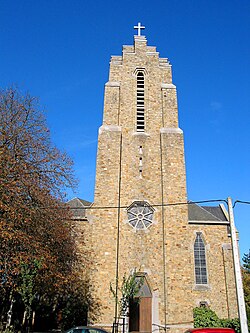
 Sacred Heart Church Sacred Heart Church | |
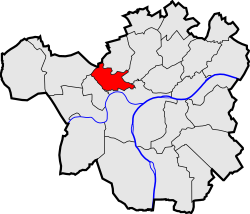
| Location of Saint-Servais | |
 Location of Saint-Servais in Namur Location of Saint-Servais in Namur | |
  | |
| Coordinates: 50°28′00″N 4°50′00″E / 50.46667°N 4.83333°E / 50.46667; 4.83333 | |
| Country | |
| Community | |
| Region | |
| Province | |
| Arrondissement | Namur |
| Municipality | Namur |
| Area | |
| • Total | 3.67 km (1.42 sq mi) |
| Population | |
| • Total | 9,588 |
| • Density | 2,600/km (6,800/sq mi) |
| Postal codes | 5002 |
| Area codes | 081 |
Saint-Servais (French pronunciation: [sɛ̃ sɛʁvɛ]; Walloon: Sint-Serwai) is a sub-municipality of the city of Namur located in the province of Namur, Wallonia, Belgium. It was a separate municipality until 1977. On 1 January 1977, it was merged into Namur.
References
| Populated places in Namur | ||
|---|---|---|
| Sub-municipalities |  | |
| Quarters, villages and hamlets | ||
This Namur Province location article is a stub. You can help Misplaced Pages by expanding it. |