| Seriqbuya Sëriqbuya, سېرىقبۇياSerikbuya, Selibuya | |
|---|---|
| Town | |
| سېرىقبۇيا, 色力布亚 (Sèlìbùyà) | |
 | |
| Coordinates: 39°18′10″N 77°49′17″E / 39.30278°N 77.82139°E / 39.30278; 77.82139 | |
| Country | People's Republic of China |
| Autonomous Region | Xinjiang |
| Prefecture | Kashgar |
| County | Maralbexi / Bachu |
| Area | |
| • Total | 280 km (110 sq mi) |
| Population | |
| • Total | 44,642 |
| • Density | 160/km (410/sq mi) |
| Ethnic groups | |
| • Major ethnic group | Uyghur |
| Time zone | GMT+6 |
| Postal code | 844000 |
| Area code | 0998 |
| Alternative Chinese name | |||||||
|---|---|---|---|---|---|---|---|
| Traditional Chinese | 色力布亞鎮 | ||||||
| Simplified Chinese | 色力布亚镇 | ||||||
| |||||||
Seriqbuya (Uyghur: سېرىقبۇيا, USY: Сериқбуя, ULY: Sëriqbuya; Chinese: 色力布亚镇; pinyin: Sèlìbùyǎ Zhèn) or Serikbuya is a town in Maralbexi (Bachu) County, Kashgar Prefecture, Xinjiang, China. It is located on Provincial Road 215, on the left (northwestern) bank of the Yarkand River and about 180 kilometers to the east of the city of Kashgar.
Name
The name Seriqbuya is from the Uyghur language and means yellow sophora alopecuroides.
History
In 1950, Seriqbuya District (色力布亚区) was established.
In 1958, Seriqbuya became a commune (色力布亚公社).'
In 1967 during the Cultural Revolution, the commune was renamed Dongfanghong Commune (literally, 'The East is Red Commune'; 东方红公社).
In 1984, Seriqbuya Town (色力布亚镇) was created.
In 2013, Seriqbuya was the site of the April 2013 Bachu unrest between ethnic Uyghurs on one side and Chinese government officials and police on the other.
Administrative divisions
| The examples and perspective in this section may not include all significant viewpoints. Please improve the article or discuss the issue. (December 2020) (Learn how and when to remove this message) |
Seriqbuya includes ten residential communities and twenty villages (Mandarin Chinese Hanyu Pinyin-derived names, except where Uyghur is provided):
Residential communities:
- Kulebeixi (库勒贝希社区), Yingbazha (英巴扎社区), Keruikebeixi (科瑞克贝希社区), Wusitangboyi (吾斯塘博依社区), Ayikule (阿依库勒社区), Yingbage (英巴格社区), Daqiakule (达恰库勒社区), Humudanbeixi (胡木旦贝希社区), Dunmaili (墩买里社区), Xialelike (夏勒力克社区)
Villages:
- Nuobeixi (诺贝希村), Kala'aikenboyi (喀拉艾肯博依村), Yingmaili (英买里村), Akewusitang (阿克吾斯塘村), Kekeligantale (科克力干塔勒村), Xiakele'awati (夏喀勒阿瓦提村), Tuogelake (托格拉克村), Kunqibulong (昆其布隆村), Kumusareyi (库木萨热依村), Pahemileke (帕合米勒克村), Aketaikaisike (阿勒台开斯克村), Akedunjiemi (阿克墩结米村), Kebaishitupu (科拜什吐普村), Saikesantale (赛克散塔勒村), Boz'ëriq (بوزئېرىق كەنت / Bozi'airike 博孜艾日克村), Ying'awati (英阿瓦提村), Keyakelike (克亚克力克村), Kuremutuogelake (库热木托格拉克村), Yolwasqotan (يولۋاسقوتان كەنت / Yaolewasikuotan 尧勒瓦斯阔坦村), Ketaikelike (科台克力克村)'
Demographics
| Year | Pop. | ±% p.a. |
|---|---|---|
| 2000 | 32,052 | — |
| 2010 | 44,642 | +3.37% |
As of 1997, Seriqbuya's population was 98.6% Uyghur.
Economy
Seriqbuya is a traditional southern Xinjiang agricultural village and market town where as many as ten-thousand people meet to trade. The business skills of local traders are strong and many traders from Seriqbuya have migrated to Beijing and Shanghai. Nearby farms produce licorice and medicinal products as a specialty.
Historical maps
Historical English-language maps including Seriqbuya:
-
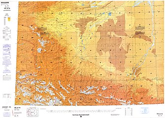
 Map including Seriqbuya (labeled as Sha-la-ka-pu-ya (Se-li-pu-ya)) (DMA, 1974)
-
 From the Operational Navigation Chart; map including Seriqbuya (labeled as Serikbuya (Se-li-pu-ya)) (DMA, 1980)
-
 Map including Seriqbuya (labeled as Seribuya (Se-li-pu-ya)) (DMA, 1984)
See also
Notes
- From map: "The representation of international boundaries is not necessarily authoritative."
- From map: "The representation of international boundaries is not necessarily authoritative"
References
- ^ 1997年巴楚县行政区划. XZQH.org (in Simplified Chinese). 2010-11-18. Archived from the original on 25 February 2020. Retrieved 13 December 2020.
- ^ 巴楚县历史沿革. XZQH.org. 14 November 2014. Archived from the original on 15 October 2017. Retrieved 25 February 2020.
,巴楚县常住总人口375883人,其中:{...}色力布亚镇32052人、{...}2010年第六次人口普查,巴楚县常住总人口336274人,其中:{...}色力布亚镇44642人,
- ^ Xie Yuzhong 解玉忠 (2003). 地名中的新疆 (in Simplified Chinese). Ürümqi: 新疆人民出版社. p. 230. ISBN 7-228-08004-1.
- D. Grammaticas, Doubts over China government claims on Xinjiang attack, BBC, 26 April 2013
- Luisetta Mudie; Parameswaran Ponnudurai. (24 April 2013). "Xinjiang Violence Leaves 21 Dead". Radio Free Asia. Retrieved 25 February 2020.
- "Overview of the Maralbeshi Incident on 23 April 2013" (PDF). World Uyghur Congress. May 2013. Archived from the original (PDF) on 23 August 2016.
- 2020年统计用区划代码和城乡划分代码:色力布亚镇 [2020 Statistical Area Numbers and Rural-Urban Area Numbers: Seriqbuya Town] (in Simplified Chinese). National Bureau of Statistics of the People's Republic of China. 2020. Archived from the original on 30 November 2020. Retrieved 13 December 2020.
- ئاپتونوم رايونلۇق خەلق قۇرۇلتىيى ۋەكىللىرى، سىياسىي كېڭەش ئەزالىرى نامراتلارنى باشقا جايغا كۆچۈرۈپ يۆلەشتە، «كۆچۈرەلەيدىغان، تۇتۇپ قالالايدىغان، ئىشقا ئورۇنلاشتۇرالايدىغان، كاپالەتكە ئىگە بولالايدىغان بولۇش» نى قانداق ئىشقا ئاشۇرۇشنى چۆرىدەپ پائال چارە- تەدبىر كۆرسەتتى. 中亚之声 (in Uyghur). Translated by Amen ئامىنە. 8 January 2020. Archived from the original on 15 December 2020. Retrieved 15 December 2020.
سېرىقبۇيا بازىرى بوزئېرىق كەنت
- Qurbanjan Qayyum قۇربانجان قېيۇم (16 October 2020). مارالبېشى ناھىيەسى: پەن-تېخنىكا پاختا تېرىش «ئادەمسىز مەشغۇلات»ىغا كۈچ قوشتى. Tianshannet (in Uyghur). Archived from the original on 16 October 2020. Retrieved 15 December 2020.
This article is a stub. You can help Misplaced Pages by expanding it. |