| This article needs additional citations for verification. Please help improve this article by adding citations to reliable sources. Unsourced material may be challenged and removed. Find sources: "Sherbro International Airport" – news · newspapers · books · scholar · JSTOR (September 2014) (Learn how and when to remove this message) |
| Sherbro International Airport | |||||||||||
|---|---|---|---|---|---|---|---|---|---|---|---|
 | |||||||||||
| Summary | |||||||||||
| Airport type | Public (closed) | ||||||||||
| Operator | Sierra Leone Airports Authority | ||||||||||
| Serves | Bonthe | ||||||||||
| Closed | 2002 | ||||||||||
| Elevation AMSL | 14 ft / 4 m | ||||||||||
| Coordinates | 07°31′55″N 012°31′06″W / 7.53194°N 12.51833°W / 7.53194; -12.51833 | ||||||||||
| Map | |||||||||||
 | |||||||||||
| Runways | |||||||||||
| |||||||||||
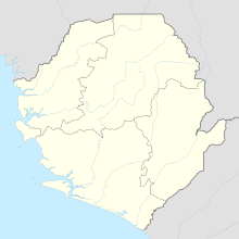
Sherbro International Airport (IATA: BTE, ICAO: GFBN) was an international airport located outside the town of Bonthe on Sherbro Island, Sierra Leone.
The airport is reported closed since around 2002, possibly in connection with the Sierra Leone Civil War.
There are plans to construct a new airport runway on Sherbro Island. The runway will be part of a new development program for the island.
References
- "Sweet Salone". Sweet Salone. Retrieved 2018-08-24.
- "Google Maps". Google Maps. Retrieved 2018-08-24.
- "Sherbro Airport". sherbrobeachhutproject.20fr.com. Retrieved 2018-08-24.
External links
| Airports in Sierra Leone | |
|---|---|
This article about an airport in Sierra Leone is a stub. You can help Misplaced Pages by expanding it. |