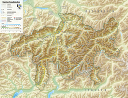
| Sufnersee | |
|---|---|
 | |
    | |
| Location | Grisons |
| Coordinates | 46°34′2″N 9°22′16″E / 46.56722°N 9.37111°E / 46.56722; 9.37111 |
| Type | reservoir |
| Primary inflows | Hinterrhein |
| Primary outflows | Hinterrhein |
| Catchment area | 194 km (75 sq mi) |
| Basin countries | Switzerland |
| Max. length | 2.2 km (1.4 mi) |
| Surface area | 0.90 km (0.35 sq mi) |
| Max. depth | 51 m (167 ft) |
| Water volume | 17.5 million cubic metres (14,200 acre⋅ft) |
| Surface elevation | 1,401 m (4,596 ft) |
Sufnersee is a reservoir between Splügen and Sufers on the Hinterrhein river in the Grisons, Switzerland, surrounded by peaks of the Adula Alps. The Sufers dam was built in 1962. The reservoir has a volume of 17.5 million m³ and its surface area is 0.90 km².
Notes
- "Swiss Dams: Sufers", Swiss Committee on Dams, accessed 3 October 2023
See also
External links
- [REDACTED] Media related to Sufnersee at Wikimedia Commons
This article related to a lake in Graubünden is a stub. You can help Misplaced Pages by expanding it. |