| Swartkops River | |
|---|---|
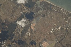
 View of South Africa taken during ISS Expedition 18, 2008 View of South Africa taken during ISS Expedition 18, 2008 | |
Swartkops River, also Zwartskop River, (Afrikaans: black hills) is a watercourse in the Eastern Cape province of South Africa. The source of the Swartkops is near Cockscombe Mountain, and it flows east into the Algoa Bay of the Indian Ocean in Bluewater Bay, just outside Gqeberha. Its two main tributaries are the northern Kwa-Zunga River and the southern Elands River. The river is also fed by Motherwell Canal, Markman Canal, and Chatty River, which are also sources of water pollution. The river's Groendal Dam was constructed in 1933. The Swartzkops watershed lies with the Uitenhage Artesian Basin. The river suffers from sewage pollution, litter, and algae blooms.
References
- ^ Maclear, Limont Gordon Alexander (March 1996). The Geohydrology of the Swartkops River Basin - Uitenhage Region, Eastern Cape (PDF) (Master of Science thesis). University of Cape Town.
- ^ "Protecting Our Estuary". Zwartkops Conservancy. 2021. Retrieved 2022-12-17.
- "Behind the Herald Headlines with Daron Mann: Swartkops Estuary pollution reaches crisis level". The Herald (South Africa). 2022-03-30. Retrieved 2022-12-17.
This article related to a river in South Africa is a stub. You can help Misplaced Pages by expanding it. |