| Taughannock Creek | |
|---|---|
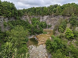
 Taughannock Creek upstream of Taughannock Falls Taughannock Creek upstream of Taughannock Falls | |
| Location | |
| Country | United States |
| State | New York |
| Region | Finger Lakes |
| Counties | Tompkins, Schuyler |
| Physical characteristics | |
| Mouth | Cayuga Lake |
| • location | Trumansburg |
| • coordinates | 42°32′57″N 76°35′57″W / 42.54917°N 76.59917°W / 42.54917; -76.59917 |
| Basin size | 67 sq mi (170 km) |
| Basin features | |
| Waterfalls | Taughannock Falls |
Taughannock Creek is a river located in Tompkins and Schuyler counties in New York. It flows into Cayuga Lake east of Trumansburg. Taughannock Falls is located on the creek.
Course
Taughannock Falls' main cataract is a 215-foot drop (66 m), making it 33 feet (10 m) taller than Niagara Falls. It is the tallest single-drop waterfall east of the Rocky Mountains. The waterfall is located along the creek, which flows through a long gorge with cliffs up to 400 feet (120 m) high.

References
- "Taughannock Creek". usgs.gov. United States Geological Survey. Retrieved May 30, 2017.
- "Taughannock Falls". World Waterfall Database. Retrieved October 1, 2015.
- "Taughannock Falls". National Geographic Guide to State Parks of the United States (4th ed.). Washington, D.C.: National Geographic Society. 2012. pp. 54–55. ISBN 1426208898. Retrieved October 2, 2015.
- O'Brian, Mike (May 24, 2015). "The Natural Wonder of Taughannock Falls State Park". Time Warner Cable News - Southern Tier. Retrieved October 2, 2015.