| This article relies largely or entirely on a single source. Relevant discussion may be found on the talk page. Please help improve this article by introducing citations to additional sources. Find sources: "Texas Highland Lakes" – news · newspapers · books · scholar · JSTOR (June 2021) |

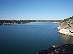
The Texas Highland Lakes are a chain of fresh water reservoirs in Central Texas formed by dams on the lower Colorado River. The Texas Colorado River winds southeast from West Texas to Matagorda Bay and the Gulf of Mexico.
The lower Colorado River basin has a history of major flooding. The Lower Colorado River Authority (LCRA) built the dams to manage floods and generate hydroelectric power in the 1930s and 1940s.
Lady Bird Lake (formerly Town Lake) and the respective Longhorn Dam are sometimes considered the seventh "honorary" lake and dam of the Highland Lakes despite being commissioned and managed by the City of Austin instead of the LCRA. Unlike the other reservoirs in the chain which were constructed primarily to prevent flooding and generate hydroelectric power, Lady Bird Lake was constructed in order to provide a cooling pond for the city's new power plant.
| Lake | Dam | Year completed | Managing Authority | Lake area (acres) | Lake length (mi) | Max lake width (ft) | Lake volume (acre-ft) | Dam length (ft) | Dam height (ft) |
|---|---|---|---|---|---|---|---|---|---|
| Lake Buchanan | Buchanan Dam | 1938 | Lower Colorado River Authority | 22,452 | 30.65 | 26,000 (4.92mi) | 880,356 | 10,988 | 145.5 |
| Inks Lake | Inks Dam | 1938 | Lower Colorado River Authority | 777 | 4.2 | 3,000 | 13,668 | 1,547.5 | 96.5 |
| Lake LBJ | Wirtz Dam | 1951 | Lower Colorado River Authority | 6,432 | 21.15 | 10,800 | 131,618 | 5,491.4 | 118.3 |
| Lake Marble Falls | Max Starcke Dam | 1951 | Lower Colorado River Authority | 613 | 5.75 | 1,080 | 7,597 | 859.5 | 98.8 |
| Lake Travis | Mansfield Dam | 1942 | Lower Colorado River Authority | 19,044 | 1,115,076 | 7,089 | 278 | ||
| Lake Austin | Tom Miller Dam | 1940 | Lower Colorado River Authority | 1,830 | 20.25 | 1,300 | 24,644 | 1,590 | 100.5 |
| Lady Bird Lake | Longhorn Dam | 1960 | City of Austin | 416 | 6 | 2,500 | 7,151 | 760 | 36 |
The two largest lakes—Buchanan and Travis—are the reservoirs that store water supply for the region. The smaller lakes—Inks, LBJ, Marble Falls and Austin—are pass-through lakes that are operated within a certain range.
In all, the six official dams of the Highland Lakes have a hydroelectric power production capacity of 295MW, with Mansfield Dam alone able to provide 108MW. While Longhorn Dam has no hydroelectric production capacity, Lady Bird Lake served as a cooling pond for the 100MW Seaholm Power Plant and the 550MW Holly Street Power Plant until they were closed in 1996 and 2007, respectively.
References
- "Highland Lakes and Dams". lcra.org. Lower Colorado River Authority. Retrieved 17 December 2021.
- Sharp, Mike. "Fun Things to do in Texas". Texas Outside. Retrieved 2021-12-17.
- Ford, Colleen (2021-03-15). "Lady Bird Lake and The Texas Highland Lakes". www.amli.com. Retrieved 2021-12-17.
- "Lady Bird Lake, Austin, Texas". www.phoslock.eu. 2021-07-14. Retrieved 2021-12-17.
- "Seaholm Power, LLC . Austin . Texas : Project : History". www.seaholmdevelopment.com. Retrieved 2021-12-18.
External links
30°34′04″N 98°22′58″W / 30.5678°N 98.3827°W / 30.5678; -98.3827
| Austin–Round Rock–San Marcos | |||||
|---|---|---|---|---|---|
| Central city |  | ||||
| Satellite cities | |||||
| Other communities | |||||
| Counties |
| ||||
| Parks and preserves | |||||
| Geography | |||||
| Bodies of water | |||||
| Transportation | |||||
- Protected areas of Burnet County, Texas
- Protected areas of Llano County, Texas
- Protected areas of Travis County, Texas
- Reservoirs in Texas
- Geography of Austin, Texas
- Bodies of water of Burnet County, Texas
- Bodies of water of Llano County, Texas
- Bodies of water of Travis County, Texas
- 1940s establishments in Texas
- Lower Colorado River Authority