Human settlement in England
| Upper Rawcliffe-with-Tarnacre | |
|---|---|
 The River Wyre at St Michael's on Wyre The River Wyre at St Michael's on Wyre | |
   | |
| Area | 15.4676 km (5.9721 sq mi) |
| Population | 629 (2011 census) |
| • Density | 41/km (110/sq mi) |
| District | |
| Shire county | |
| Region | |
| Country | England |
| Sovereign state | United Kingdom |
| Post town | PRESTON |
| Postcode district | PR3 |
| Police | Lancashire |
| Fire | Lancashire |
| Ambulance | North West |
| |
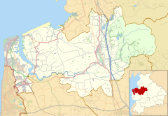
Upper Rawcliffe-with-Tarnacre is a civil parish on the Fylde, in the Borough of Wyre, in Lancashire, England. It had a population of 604 in 2001, increasing to 629 at the 2011 Census. The only settlements in the parish are the village of St Michael's on Wyre and the tiny hamlet of Ratten Row. The River Wyre passes through the parish, and the River Brock joins the Wyre on the parish boundary.
Upper Rawcliffe-with-Tarnacre was once a township in the ancient parish of St Michael's on Wyre. This became a civil parish in 1866, forming part of the Garstang Rural District from 1894 till 1974. It has since become part of the Borough of Wyre.
Along with Great Eccleston, Kirkland, Out Rawcliffe and Inskip-with-Sowerby, Upper Rawcliffe-with-Tarnacre forms part of the Great Eccleston ward of Wyre Borough Council.
See also
References
- "Parish headcount" (PDF). Archived from the original (PDF) on 10 December 2006. Retrieved 13 April 2008.
- UK Census (2011). "Local Area Report – Upper Rawcliffe-with-Tarnacre Parish (E04005338)". Nomis. Office for National Statistics. Retrieved 27 March 2021.
- "Upper Rawcliffe With Tarnacre Tn/CP through time". visionofbritain.org.uk. GB Historical GIS / University of Portsmouth. Retrieved 5 January 2022.
- "Great Eccleston". MARIO. Lancashire County Council. Retrieved 5 January 2022.
- "Great Eccleston". Ordnance Survey Linked Data Platform. Ordnance Survey. Retrieved 5 January 2022.
External links
| Neighbouring parishes | ||||||||||||||||
|---|---|---|---|---|---|---|---|---|---|---|---|---|---|---|---|---|
| ||||||||||||||||
| Geography of the Borough of Wyre | |||||||
|---|---|---|---|---|---|---|---|
| Towns | |||||||
| Villages |
| ||||||
| Parishes | |||||||
| Topography |
| ||||||
This Lancashire location article is a stub. You can help Misplaced Pages by expanding it. |
