| Vaxön | |
|---|---|
   | |
| Coordinates: 59°24′15″N 18°19′53″E / 59.40417°N 18.33139°E / 59.40417; 18.33139 | |
| Country | Sweden |
| Province | Uppland |
| County | Stockholm County |
| Municipality | Vaxholm Municipality |
| Time zone | UTC+1 (CET) |
| • Summer (DST) | UTC+2 (CEST) |
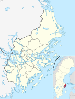
Vaxön is an island in the Stockholm archipelago in Sweden. It is situated in Vaxholm Municipality and Stockholm County. Until 2020, the urban area of Vaxholm, as defined by Statistics Sweden, was entirely contained within the island of Vaxön. However in that year, the adjacent island of Kullö was redefined as part of the urban area.
Vaxön is linked to the Swedish mainland by a series of road bridges, and the Vaxholmsleden [sv] car ferry connects Vaxön to the island of Rindö across the Kodjupet strait. A bus service connects the island to Stockholm city, whilst the Waxholmsbolaget and other ferry lines also provide boat services to central Stockholm and many of the other islands of the Stockholm archipelago, using a mixture of classic steamers and modern fast passenger ferries.
References
- "Interactive map - Vaxön". hitta.se. Archived from the original on 12 June 2023. Retrieved 12 June 2023.
- "Avregistrerade och nyregistrerade statistiska tätorter 2020" [Deregistered and newly registered statistical agglomerations in 2020] (in Swedish). Statistics Sweden. Archived from the original on 12 June 2023. Retrieved 12 June 2023.
- "Vaxholmsleden" (in Swedish). Trafikverket. Archived from the original on 23 May 2023. Retrieved 22 May 2023.
- "Linfärjan Vaxholmen" (in Swedish). Vaxholms stad. Archived from the original on 13 September 2017. Retrieved 13 September 2017.
| Localities in Vaxholm Municipality, Stockholm County, Sweden | |
|---|---|
| Urban areas | |
| Islands | |
| Other places | |
This article about a location in Stockholm County, Sweden is a stub. You can help Misplaced Pages by expanding it. |