| Wellington Crescent | |
|---|---|
| Neighbourhood | |
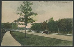
 Postcard of Wellington Crescent in 1908 Postcard of Wellington Crescent in 1908 | |
| Coordinates: 49°52′35″N 97°10′50″W / 49.8765°N 97.1806°W / 49.8765; -97.1806 | |
| Country | |
| Province | |
| City | Winnipeg |
| City Ward | River Heights-Fort Garry |
| Area | |
| • Land | 1.0 km (0.4 sq mi) |
| Population | |
| • Total | 1,655 |
| • Density | 1,703/km (4,410/sq mi) |
| Racial Group (2016) | |
| • White | 83.9% |
| • Aboriginal | 7.6% |
| • Visible minority | 8.5% |
Wellington Crescent is an affluent neighbourhood in Winnipeg, Manitoba, Canada. It is known for its stately homes and for a small commercial area along Academy Road.
It is in the northern section of the River Heights community area, along the Assiniboine River, which marks the neighbourhood's northern boundary. Its other boundaries are Academy Road to the south, and the train tracks to the west.
Demographics and crime
With a total land area of 1 km (0.39 sq mi) and a total population of 1,655 residents, Wellington Crescent has a population density of 1,703/km (4,410/sq mi) according to the 2016 census.
Wellington Crescent is one of Winnipeg's wealthier neighbourhoods, with a median household income of CA$153,349 in 2015, more than double the city's total median of $68,331. The 615 dwellings in Wellington Crescent are worth an average of $686,148.
Crime
Wellington Crescent has low rates of violent crime. In 2012, there was only one robbery, making the rate 62.3 per 100,000 residents. The break-and-enter rate was 996.9 per 100,000 residents and there were two attempted auto theft, but no actual cars stolen.
| Offense category | Jan 2020 | Jan 2021 | Jan 2022 |
|---|---|---|---|
| Property crimes | 204 | 169 | 162 |
| Violent crimes | 22 | 10 | 16 |
| Other crimes | 7 | 10 | 6 |
| Controlled Drugs and Substances Act | 2 | ||
| Criminal Code traffic violations | 4 | 10 | 1 |
| Total | 239 | 199 | 185 |
References
- ^ "2016 Census - Wellington Crescent" (PDF). July 24, 2019.
- "Electoral Wards - City of Winnipeg".
- "About Crimestat - Disclaimer for Statistics Presented - Crimestat - City of Winnipeg". Winnipeg.ca. 2008-01-01. Retrieved 2013-09-01.
- Winnipeg Police Service. 2022 April 4. "January CrimeMaps - 2022." CrimeMaps. Retrieved 2022-05-08.
| Neighbourhoods adjacent to Wellington Crescent, Winnipeg | ||||||||||||||||
|---|---|---|---|---|---|---|---|---|---|---|---|---|---|---|---|---|
| ||||||||||||||||
| Neighbourhoods in Winnipeg | |
|---|---|
| Assiniboine South |
|
| Downtown |
|
| Fort Garry |
|
| Inkster |
|
| Point Douglas |
|
| River East |
|
| River Heights |
|
| Seven Oaks |
|
| St. Boniface |
|
| St. James-Assiniboia |
|
| St. Vital |
|
| Transcona |
|
| Others | |
This Manitoba location article is a stub. You can help Misplaced Pages by expanding it. |