| West Lake Okoboji | |
|---|---|
 | |
  | |
| Location | Dickinson County, Iowa |
| Coordinates | 43°23′04″N 095°09′34″W / 43.38444°N 95.15944°W / 43.38444; -95.15944 |
| Catchment area | 125 sq mi (320 km) |
| Basin countries | United States |
| Surface area | 3,847 acres (1,557 ha) |
| Average depth | 39 ft (12 m) |
| Max. depth | 154 ft (47 m) |
| Surface elevation | 1,398 ft (426 m) |
| Islands | 0 |
| Settlements | Arnolds Park Okoboji Wahpeton West Okoboji |

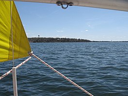
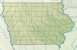
West Okoboji Lake (sometimes known as West Lake Okoboji) is a natural body of water, approximately 3,847 acres (15.57 km) in area, in Dickinson County in northwestern Iowa in the United States. It is part of the chain of lakes known as the Iowa Great Lakes. The area was long inhabited by the Santee or Dakota Sioux. The Dakota-language name for the lake was Minnetonka, meaning "great waters".
The cities of Arnolds Park, Okoboji, West Okoboji, and Wahpeton sit on its shore. Okoboji was derived from the Dakota name for the lake, and Wahpeton was the name of one of the major historic Sioux bands in the nineteenth century. Today the Sisseton-Wahpeton Sioux are a federally recognized tribe.
The lake has exceptional water quality and color, and is included on the DNR’s Outstanding Iowa Waters list. The lake has long been noted for its blue waters, with an author drawing comparison to "Guarda(sic) or Lake of Zürich" in the 1895 Midland Monthly Magazine. The statement that West Okoboji is "one of only three blue water lakes in the world" is a long-repeated myth, which has been refuted. The statement has appeared in numerous tour guides since the early 20th century. In an article in the National Geographic May 1981 edition from staff writer Harvey Arden, the Okoboji and Spirit lakes were called "blue - water" lakes.
Geography
The lake's maximum depth is 136 feet (41 m), making it the deepest lake in Iowa and second in size only to Spirit Lake. The mean depth is 39 feet (12 m). The drainage area of the lake is approximately 125 square miles (320 km).
Recreation
The depth of the lake makes it a popular regional destination for motor boating, water skiing, sailing, and swimming. The lake is also a popular fishing destination in the region. The main catches in the lake are yellow perch, bluegill, and walleye. It also contains significant populations of smallmouth bass, northern pike, muskie, crappie and white bass, black bass.
See also
References
- ^ West Okoboji: One of Only 3 Blue Water Lakes in the World? Iowa Department of Natural Resource, reprinted from the July/August 2016 issue of Iowa Outdoors magazine.
- Iowa's Outstanding Waters List. Iowa DNR, January 2014
- Byers, S. H. M. - Resting at Okobiji. The Midland Monthly. United States: Johnson Brigham, 1895. Volume 3
- Des Moines Register Q&A April 7, 1985. Roger W. Bachmann, professor, Department of Animal Ecology, Iowa State University, Ames.
- Rock Island Employes' Magazine. United States: Chicago, Rock Island and Pacific Railway Company, 1924. Volume 19
- A Guide to Estherville, Iowa, Emmet County and Iowa Great Lakes Region. United States: Estherville Enterprise Print, 1939.
- Arden, Harvey - Iowa, America's Middle Earth. National Geographic (USA), May 1981 "Had they been looking for blue - water lakes , however , they might have tried northwest Iowa's Great Lakes resort area , centered around beautiful Lake Okoboji and Spirit Lake."
- Site: 06604200, WY: 2007 Water-Data Report 2007 06604200 WEST OKOBOJI LAKE AT LAKESIDE LABORATORY NEAR MILFORD, IA U.S. Geological Survey
- ^ Dockter, Mason - Fishing at the Iowa Great Lakes: 'This lake is so full of fish, it's crazy'. Sioux City Journal, August 1, 2021
External links
- Iowa Department of Natural Resources site on East Okoboji Lake
- University of Iowa site on West Okoboji Lake chemistry
- U.S. Geological Survey site on West Okoboji Lake current temperature
- Okoboji Underwater Photography Documentary produced by Iowa Public Television
- U.S. Geological Survey Geographic Names Information System: West Okoboji Lake