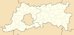
| Wijgmaal | |
|---|---|
| Sub-municipality of Leuven | |
 St Hadrian Church St Hadrian Church | |
| Location of Wijgmaal | |
 Location of Wijgmaal in Leuven Location of Wijgmaal in Leuven | |
  | |
| Coordinates: 50°55′33″N 4°42′06″E / 50.92583°N 4.70167°E / 50.92583; 4.70167 | |
| Country | |
| Community | |
| Region | |
| Province | |
| Arrondissement | Leuven |
| Municipality | Leuven |
| Area | |
| • Total | 4.59 km (1.77 sq mi) |
| Population | |
| • Total | 3,793 |
| • Density | 830/km (2,100/sq mi) |
| Postal codes | 3018 |
| Area codes | 016 |
Wijgmaal (Dutch pronunciation: [ˈʋɛixmaːl]) is a village of the city of Leuven located in the province of Flemish Brabant, Flemish Region, Belgium. Before the fusion of the Belgian municipalities in 1977, it was a part of the municipality of Herent. On 1 January 1977, it was merged into Leuven. Wijgmaal has never been a municipality, but in some sources, Wijgmaal is mentioned as a "deelgemeente" (sub-municipality).
References
- Leuven.be: Wijgmaal
- "Deelgemeenten | Stad Leuven". leuven.be (in Dutch). 2019-09-09. Retrieved 2024-01-24.
External links
- [REDACTED] Media related to Wijgmaal at Wikimedia Commons
| Populated places in Leuven | ||
|---|---|---|
| Sub-municipalities | ||
| Neighbourhoods, villages and hamlets | ||
This Flemish Brabant location article is a stub. You can help Misplaced Pages by expanding it. |