| Windy Run | |
|---|---|
 Windy Run near its confluence with the Potomac Windy Run near its confluence with the Potomac | |
 | |
| Location | |
| Country | United States |
| State | Virginia |
| County | Arlington County |
| Physical characteristics | |
| Mouth | |
| • location | Potomac River |
| • elevation | 0 feet (0 m) |
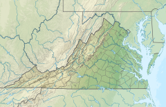
Windy Run is a small stream in Arlington County, Virginia. From its source near Lorcom Lane, Windy Run flows on a northeastern course and empties into the Potomac River within the Federal parklands of the George Washington Memorial Parkway. Windy Run is surrounded predominantly by forests. It is known by many of the Arlington locals as simply "The Falls".
Parks along Windy Run
- Windy Run Park (Arlington County Parks and Recreation)
- George Washington Memorial Parkway (US National Park Service)
See also
Notes
- Coordinates of Windy Run at confluence with Potomac River: 38°54′21″N 77°05′37″W / 38.90583°N 77.09370°W / 38.90583; -77.09370 (Windy Run at confluence with Potomac River)
This Arlington County, Virginia state location article is a stub. You can help Misplaced Pages by expanding it. |
This article related to a river in Virginia is a stub. You can help Misplaced Pages by expanding it. |