| Yuba Pass | |
|---|---|
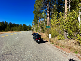
 Yuba Pass Sign on CA State Route 49 Yuba Pass Sign on CA State Route 49 | |
| Elevation | 6,710 ft (2,045 m) |
| Traversed by | |
| Location | Sierra County, California, U.S. |
| Range | Sierra Nevada |
| Coordinates | 39°37′03″N 120°29′24″W / 39.61750°N 120.49000°W / 39.61750; -120.49000 |
| Topo map | USGS Sattley |
 | |
Yuba Pass is a mountain pass on State Route 49 in Sierra County in the U.S. state of California. The pass lies at an elevation of 6,710 ft (2,050 m) about 3.4 air miles west of Sattley, on the divide between the North Yuba River and the Middle Fork Feather River (Sierra Valley). Thus, unlike most of the well-known Sierra Nevada passes, including the much lower Beckwourth Pass on the east edge of the Sierra Valley, Yuba Pass does not lie on the Great Basin Divide.
This Yuba Pass should not be confused with Yuba Gap, a minor mountain pass along Interstate 80 on the Nevada-Placer county line.
History
| This section needs expansion. You can help by adding to it. (June 2022) |
Gallery
See also
References
- ^ U.S. Geological Survey Geographic Names Information System: Yuba Pass (Sierra County)
- "Yuba Pass - OHV Parks CA GOV". Retrieved 2022-06-26.
| Sierra Nevada | ||||||||||||
|---|---|---|---|---|---|---|---|---|---|---|---|---|
| Mountains |
| |||||||||||
| Passes | ||||||||||||
| Rivers | ||||||||||||
| Lakes | ||||||||||||
| Protected areas |
| |||||||||||
| Communities | ||||||||||||
| Ski areas | ||||||||||||
| Trails | ||||||||||||

