| This article does not cite any sources. Please help improve this article by adding citations to reliable sources. Unsourced material may be challenged and removed. Find sources: "Zemplín Mountains" – news · newspapers · books · scholar · JSTOR (March 2019) (Learn how and when to remove this message) |

- not to be confused with the nearby Zemplén Mountains
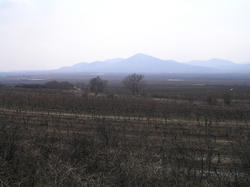
The Zemplín Mountains is a small mountain range in southeastern Slovakia, geologically part of the Mátra-Slanec Area of the Inner Western Carpathians.
The range of about 101 square kilometers is near the border of Hungary and its Tokaj wine region. The highest mountain of the range is Rozhladňa (469 meters). An important river is Roňava which also forms the border with Hungary; another river with its headwaters here is the Bodrog.
48°27′N 21°43′E / 48.450°N 21.717°E / 48.450; 21.717
Categories: