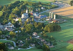
Municipality in French Community, Belgium
Ferrières (French pronunciation: [fɛʁjɛʁ] Walloon : Ferire ) is a municipality of Wallonia located in the province of Liège , Belgium .
On January 1, 2006, Ferrières had a total population of 4,449. The total area is 56.90 km with a population density of 78 inhabitants per km.
The municipality consists of the following districts : Ferrières, My (pronounced "Mee"), Vieuxville (including the hamlet of Sy ), Werbomont , and Xhoris .
See also
References
"Wettelijke Bevolking per gemeente op 1 januari 2018" . Statbel. Retrieved 9 March 2019.
External links
Places adjacent to Ferrières, Belgium
Categories :
Ferrières, Belgium
Add topic
Text is available under the Creative Commons Attribution-ShareAlike License. Additional terms may apply.
**DISCLAIMER** We are not affiliated with Wikipedia, and Cloudflare.
The information presented on this site is for general informational purposes only and does not constitute medical advice.
You should always have a personal consultation with a healthcare professional before making changes to your diet, medication, or exercise routine.
AI helps with the correspondence in our chat.
We participate in an affiliate program. If you buy something through a link, we may earn a commission 💕
↑

 Flag
Flag Coat of arms

